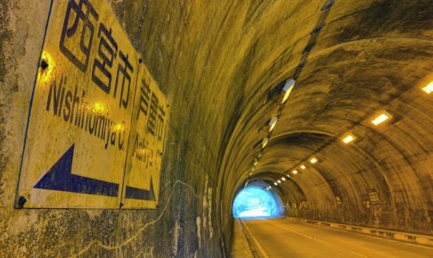
A corner where we simply introduce the borders between Nishinomiya City and neighboring cities: [Nishinomiya City Borders] By the way, 市境 is apparently read “shikyo,” not “shizakai.” Though it won’t come up that way when typing it.
Lately, whenever I’m walking around, I can’t help but notice city borders.
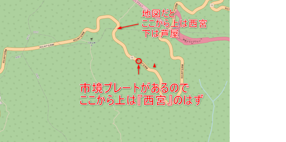
This time, we’re introducing a spot where, according to the city-border plate, it should be Nishinomiya, but on Google Maps it’s completely in Ashiya.
Here it is on Street View↓↓
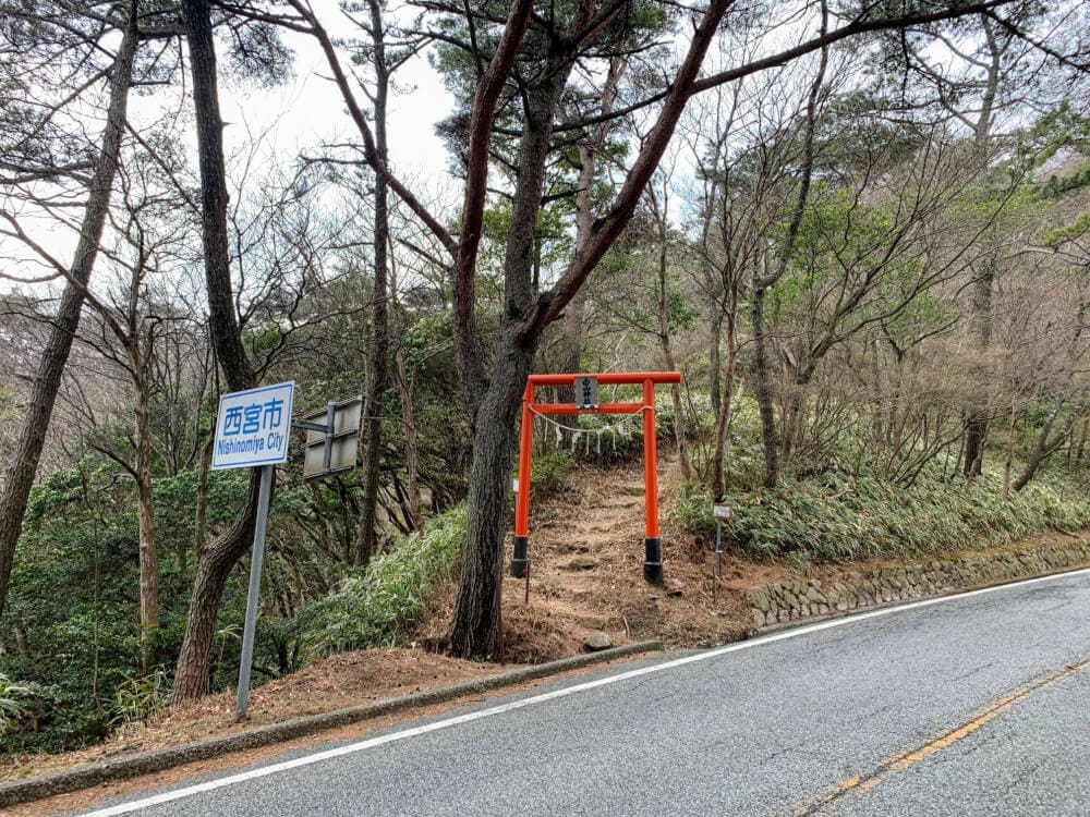
There’s definitely a plate marking the city border that says “Nishinomiya.”
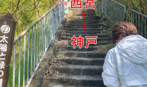
Can you tell where this is?
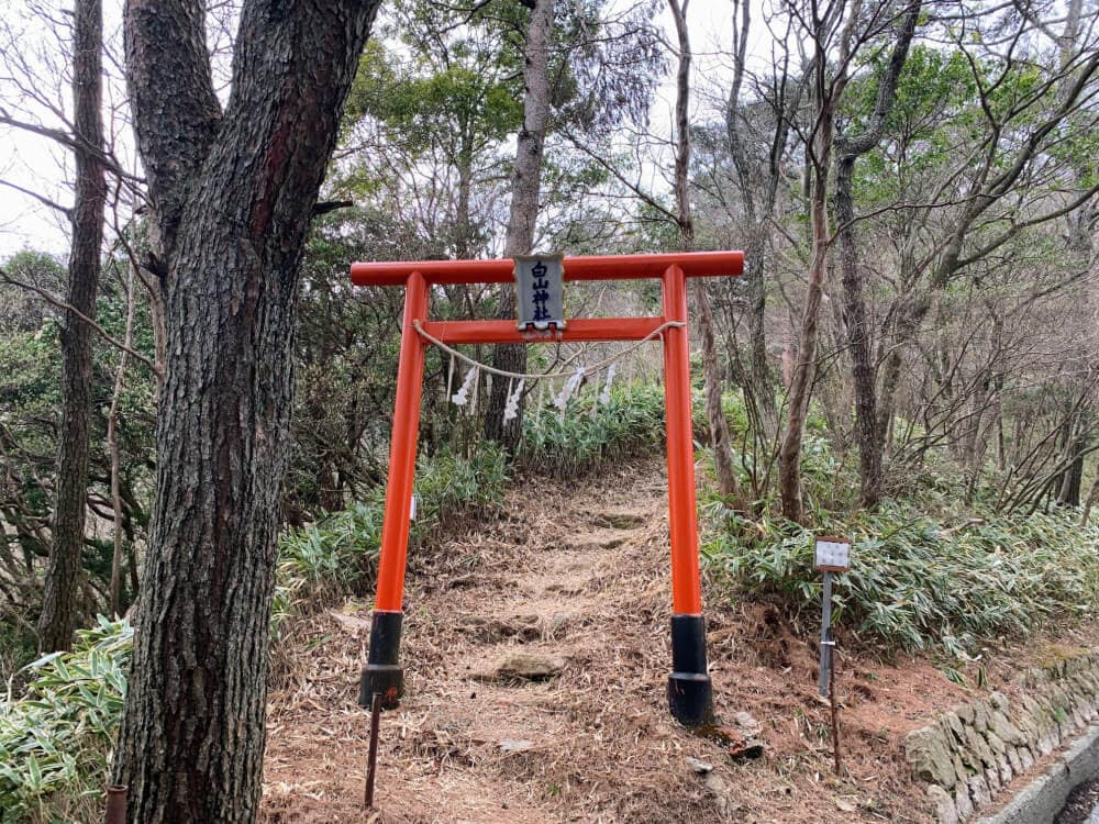
It’s the spot on Prefectural Route 16 with the torii gate for “Hakusan Shrine.”
It’s labeled “Hakusan Shrine” here, but the main torii gate says “Ishinohoden Hakusan no Miya.”
The spot with the city-border plate and the torii gate is around here on the map↓↓

“© OpenStreetMap contributors”
The city-border plate↓↓
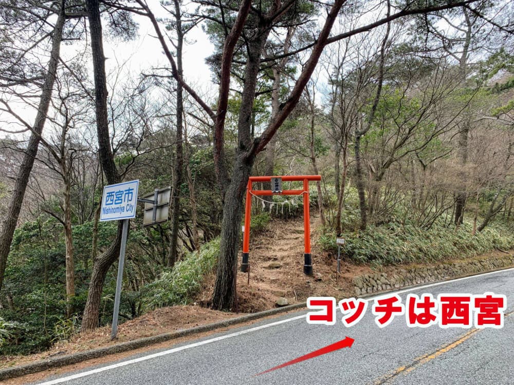
The area above the plate should be Nishinomiya, but on the map it’s totally Ashiya…
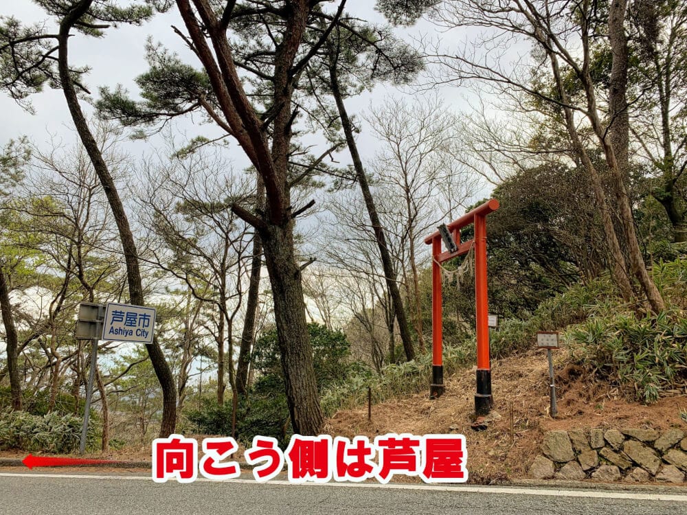
So there you have it: a place where there’s a city-border plate even though it’s nowhere near the actual city border.
I always thought city-border plates were placed right on city borders, but maybe there are exceptions…