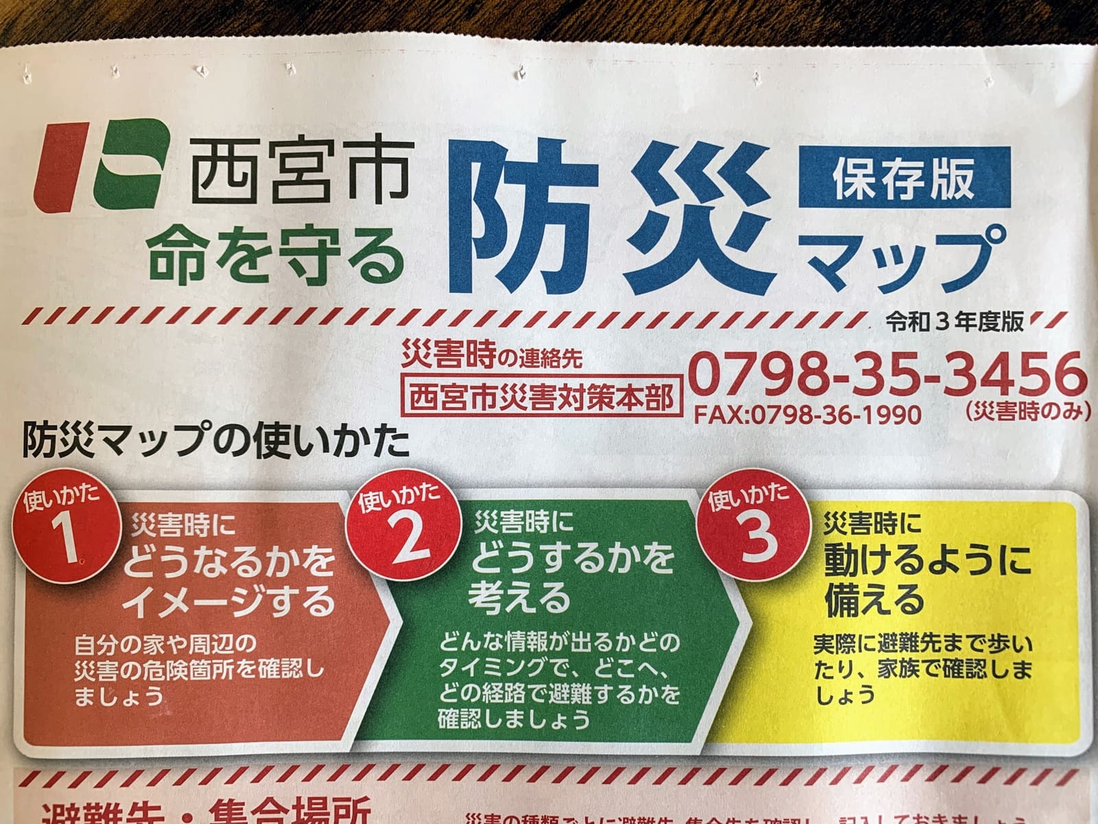
It looks like the “Nishinomiya City Disaster Prevention Map” is being distributed to every household in Nishinomiya.
This article is brought to you with support from “GenkiStyle,” a foot treatment clinic that supports Nishinomiya Tsushin.
Here it is↓
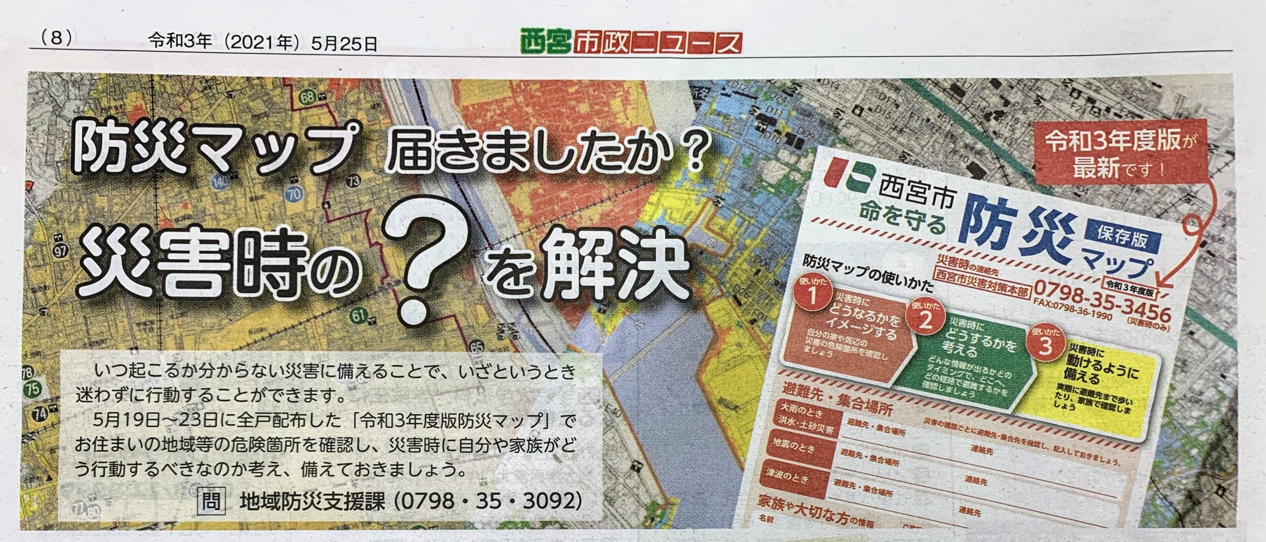
If you haven’t received the disaster prevention map, see below↓↓↓
Please contact the Nishinomiya City Silver Human Resources Center at 0120-72-4833 (9:00 a.m. to 5:00 p.m.).
If you want to check it by downloading it, see below↓↓↓
Download
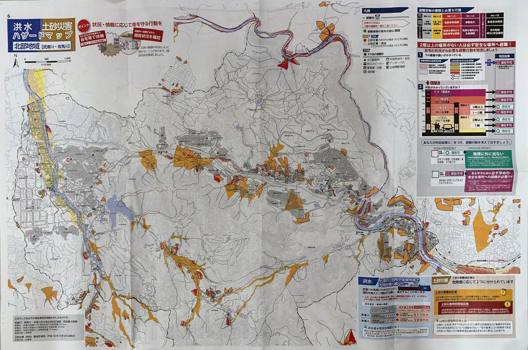
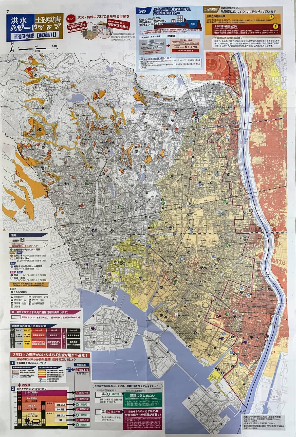
*Among the Nishinomiya City Disaster Prevention Maps, the flood hazard maps shown for the northern area 【Muko River・Arima River】 and the southern areas 【Muko River】・【Shukugawa】 are flood inundation assumption area maps (flood hazard maps) for “flooding” as stipulated in Article 11, Item 1 of the Enforcement Regulations of the Flood Control Act.
Nishinomiya City Disaster Prevention Map (FY2021 Edition) How to use the map, preparedness information, etc. (PDF: 1,360KB)
From the Nishinomiya City website
Things to Check on the Disaster Prevention Map
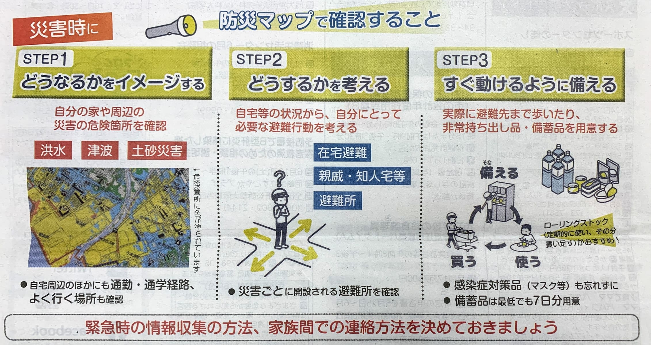
It’s important to decide on how family members will contact each other! I had decided which evacuation shelter my family would gather at (^o^)/
Nishinomiya City also introduces how to use the disaster prevention map on YouTube↓
Disaster Prevention Map Overview
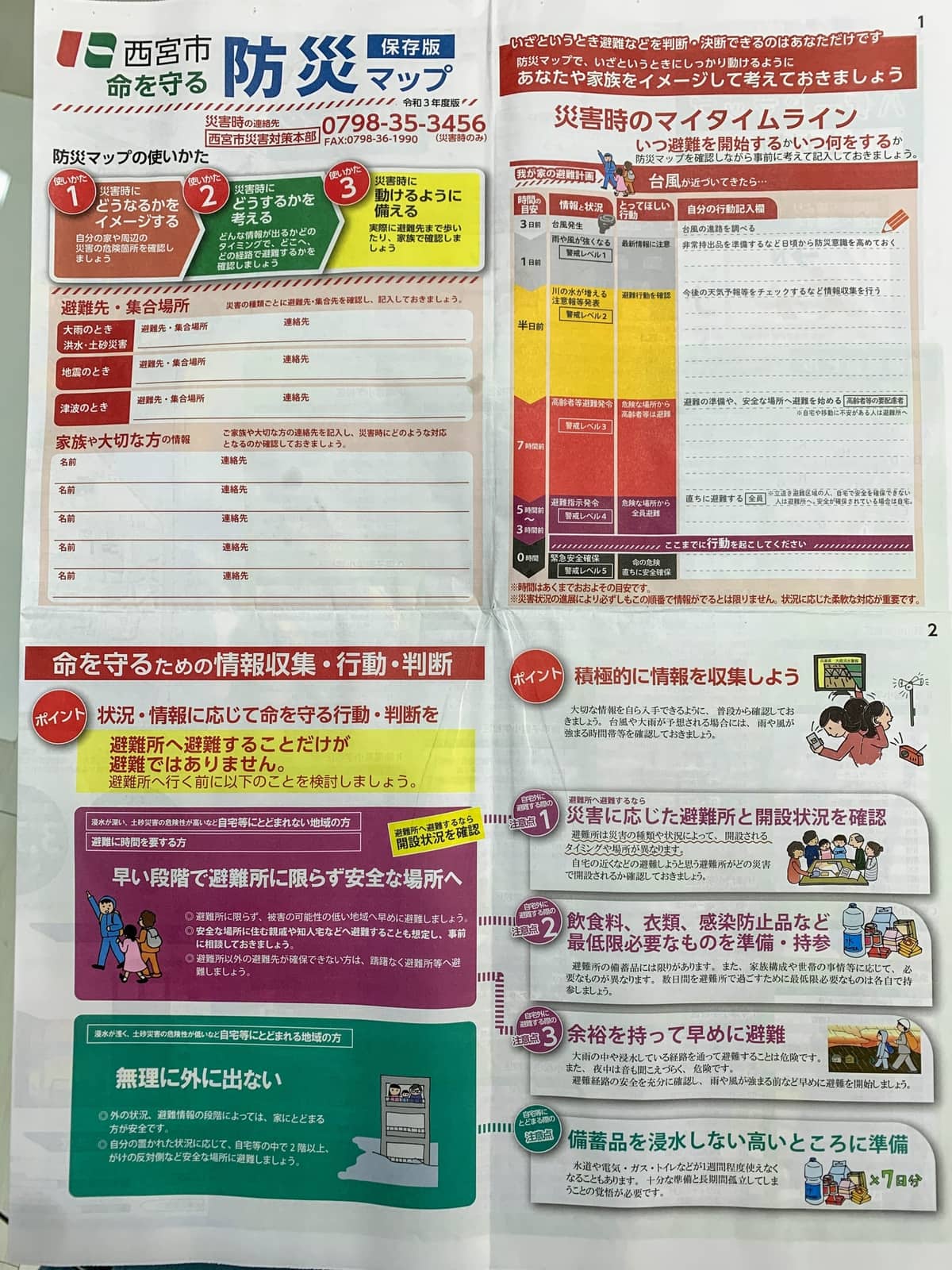
You can write in your evacuation destination, meeting place, and contact information!
Having it somewhere visible is important! It’s also reassuring for people who aren’t part of the digital generation!
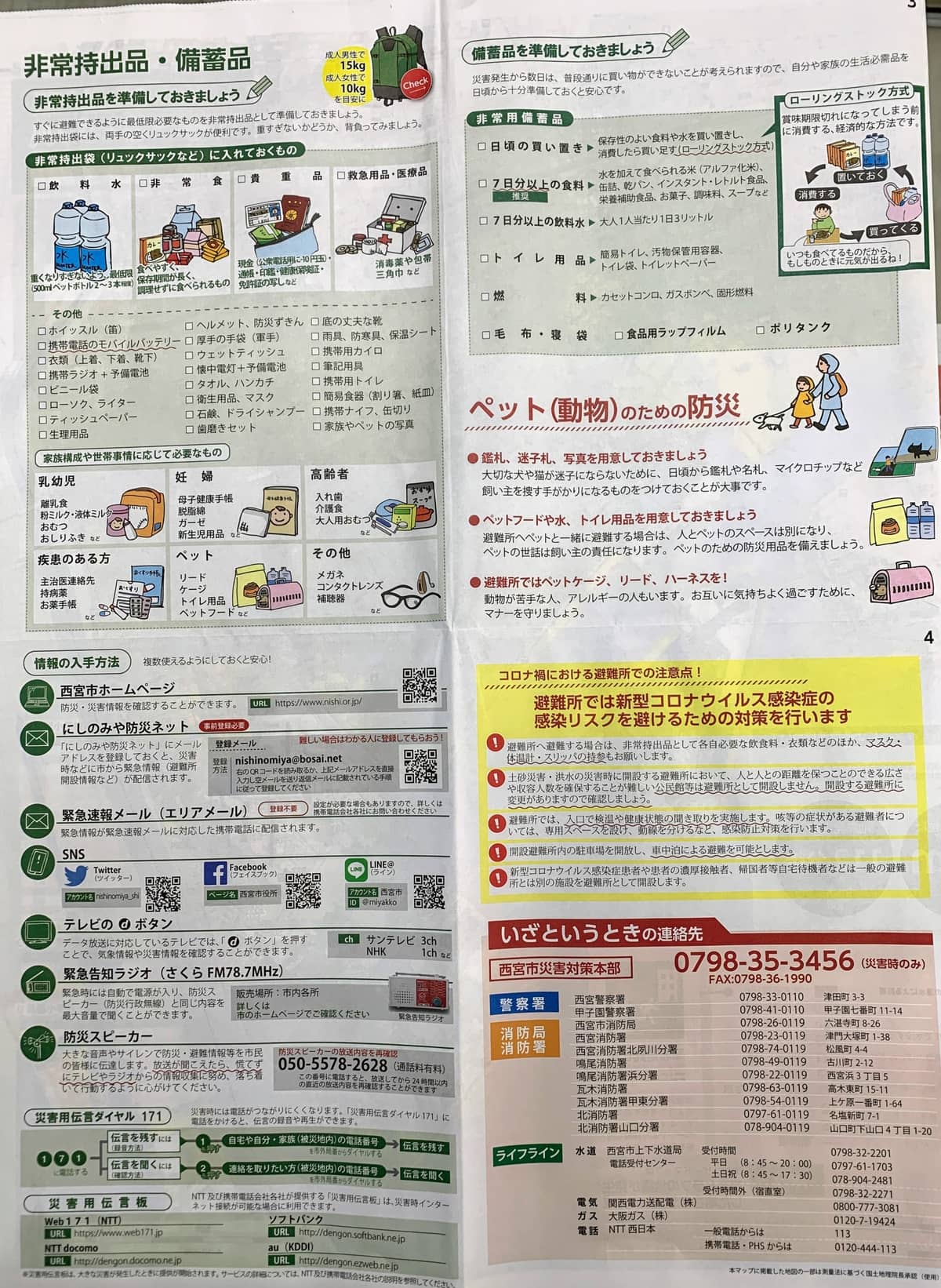
Disaster preparedness for pets is important too!
Tsunami hazard map↓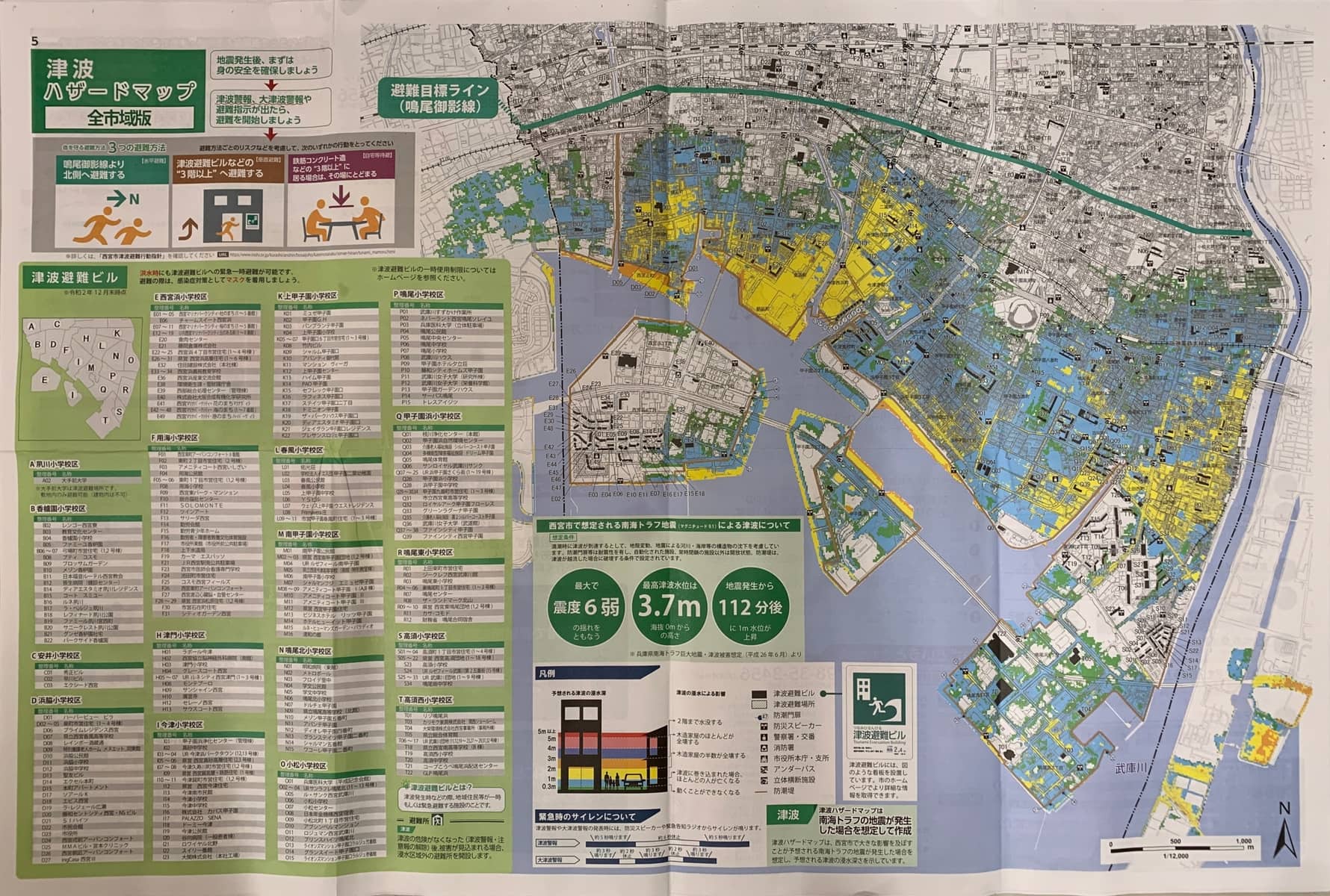
Flood and Landslide Hazard Map↓
Northern area
Southern area 【Muko River】
Southern area 【Shukugawa】

Finally
This year’s rainy season started earlier than usual.
It would be good if families could prepare for emergencies together, assuming all kinds of situations such as earthquakes, tsunamis, floods, and landslides (^o^)/