On Tuesday, November 5, as part of the “Hyogo Prefecture Tsunami Evacuation Drill” in preparation for a Nankai Trough earthquake, smartphones will all start sounding emergency alerts from 10:00 a.m.!
Here it is↓
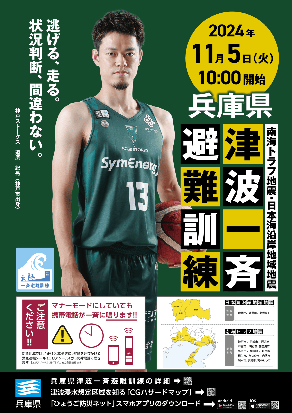
November 5 is “World Tsunami Awareness Day”. In Hyogo Prefecture, a tsunami evacuation drill is held every year on this day.
Hyogo Prefecture Tsunami Evacuation Drill
If you are in one of the following areas, your smartphone’s alert tone will sound during the 10:00 a.m. drill, and you will receive an emergency alert email urging evacuation📱The sound will go off even if your phone is on silent mode, so please be prepared.
Nankai Trough Earthquake Tsunami Inundation Assumption Area
- Kobe City
- Amagasaki City
- Nishinomiya City
- Ashiya City
- Akashi City
- Kakogawa City
- Takasago City
- Harima Town
- Himeji City
- Aioi City
- Tatsuno City
- Ako City
- Sumoto City
- Awaji City
- Minamiawaji City
Japan Sea Coastal Earthquake Tsunami Inundation Assumption Area
- Toyooka City
- Kami Town
- Shinonsen Town
For details→Hyogo Prefecture official website
Drill Details in Nishinomiya
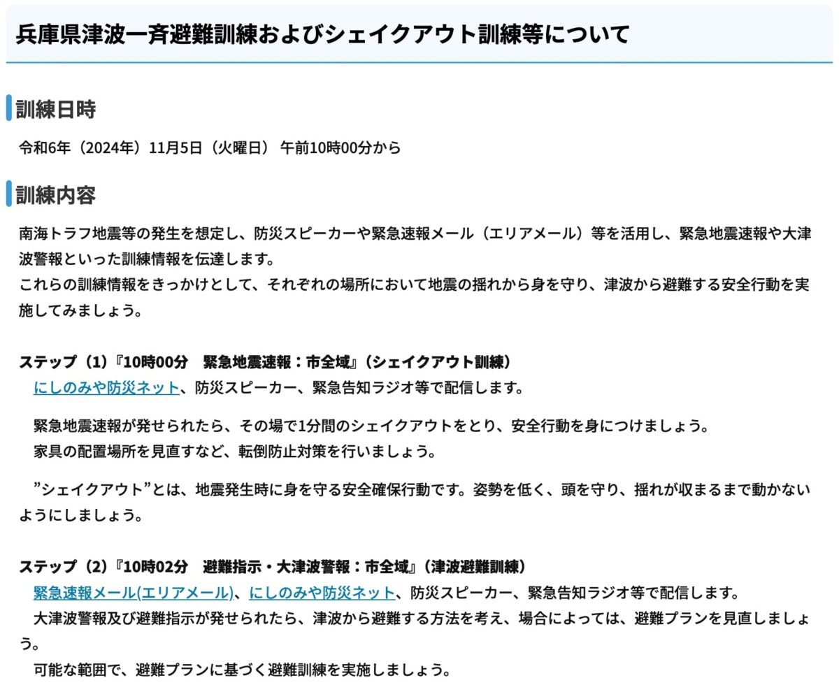
- At 10:00, an earthquake early warning will be broadcast through disaster prevention speakers and other systems
- At 10:02, an emergency alert email (Area Mail) will be sent
Please try taking part in the ShakeOut drill by getting under a desk, or practice moving away if you are near something that could fall over.
What is a ShakeOut drill?↓

Tsunami Hazard Map↓
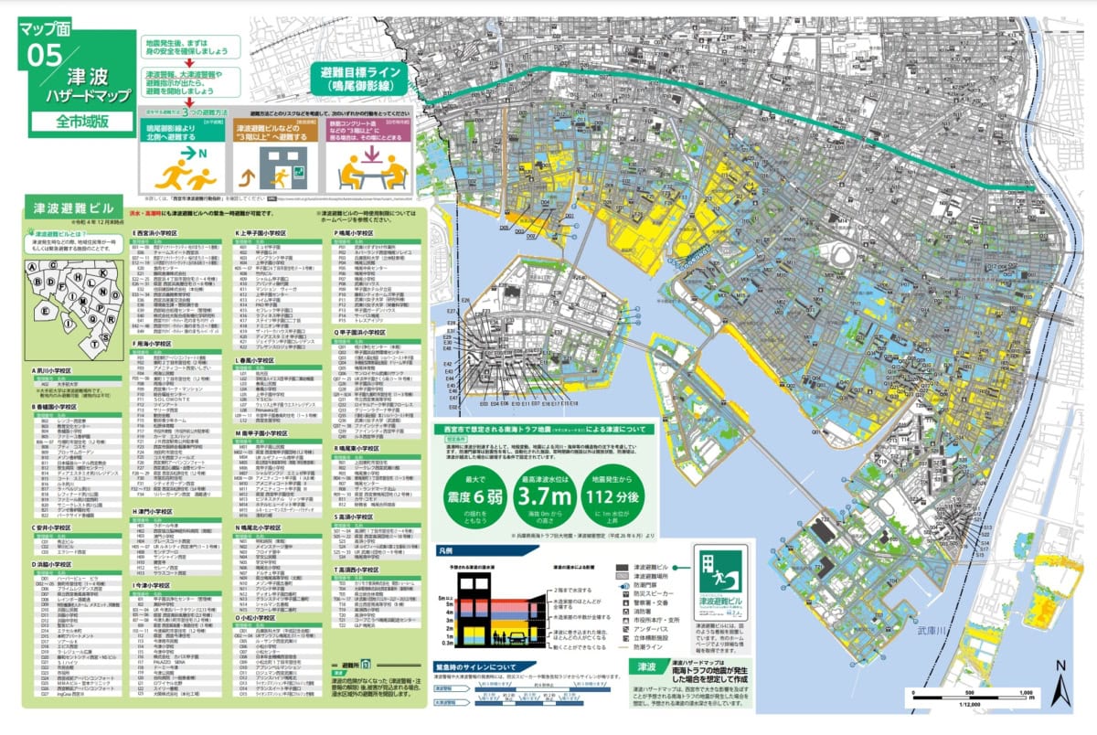
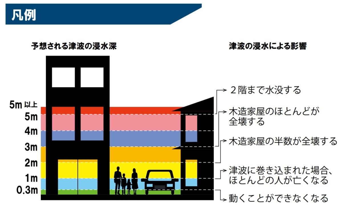
Color Explanation↓
Zoomable map↓
(Map Side 5) Tsunami Hazard Map PDF
Finally
If a Nankai Trough earthquake occurs, Nishinomiya City is expected to experience shaking of up to lower 6 on the Japanese seismic intensity scale. About 112 minutes after the earthquake, the water level is projected to rise by 1 meter, with a maximum tsunami water level of 3.7 meters. Please use this drill as an opportunity to check your actual evacuation routes and destinations, and to review what you should do in the event of a disaster.