Typhoon No. 15 looks set to make its closest approach to Nishinomiya around 11 a.m.Information as of 4 a.m.
Quoted from the Japan Meteorological Agency | Typhoon Information. This is the forecast circle as of 4 a.m. on Friday, September 5.
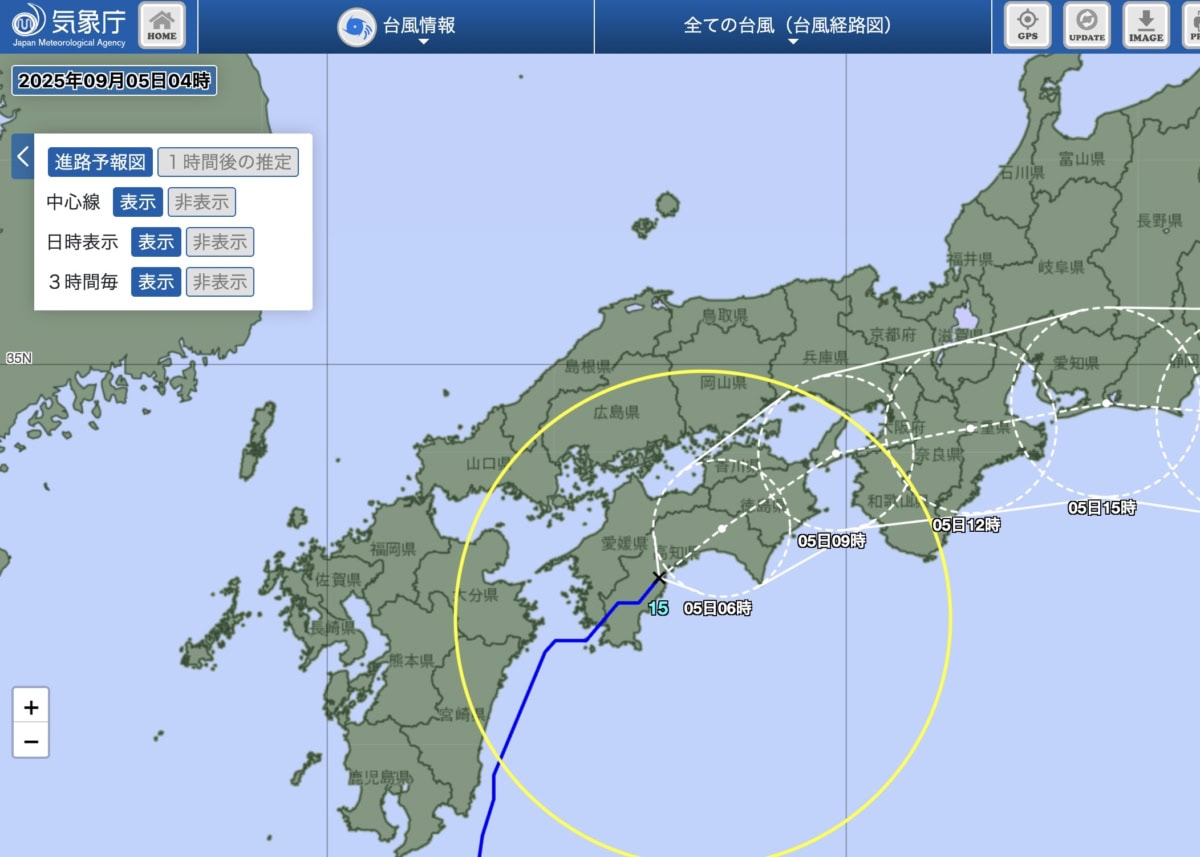
According to the latest projected path, the typhoon is expected to move northeast, reaching the area near the Kii Channel at 9 a.m. on Friday the 5th, then passing east of the Kii Peninsula by noon. Nishinomiya is expected to fall on the left side of its path(northeastern Osaka Bay).
In short…
- Estimated closest approach: around 9 to 11 a.m. on Friday the 5th
- Peak winds: around 10 a.m. to noon on Friday the 5th (most likely before noon)
Winds are likely to strengthen from the south to southwest just before the typhoon approaches, and may become even stronger when the direction shifts west to northwest after it passes. - Peak rain: from morning to before noon, around 8 to 11 a.m.
This track makes it easy for short bursts of heavy rain to arrive first if a band of rain clouds passes over the area. - If the track shifts north, the peak may come earlier; if it shifts south, it may be delayed by about an hour.
*This article is an estimate by a non-meteorologist based on publicly available forecast circles. Please check the Japan Meteorological Agency or TV weather reports for the most accurate and up-to-date information.
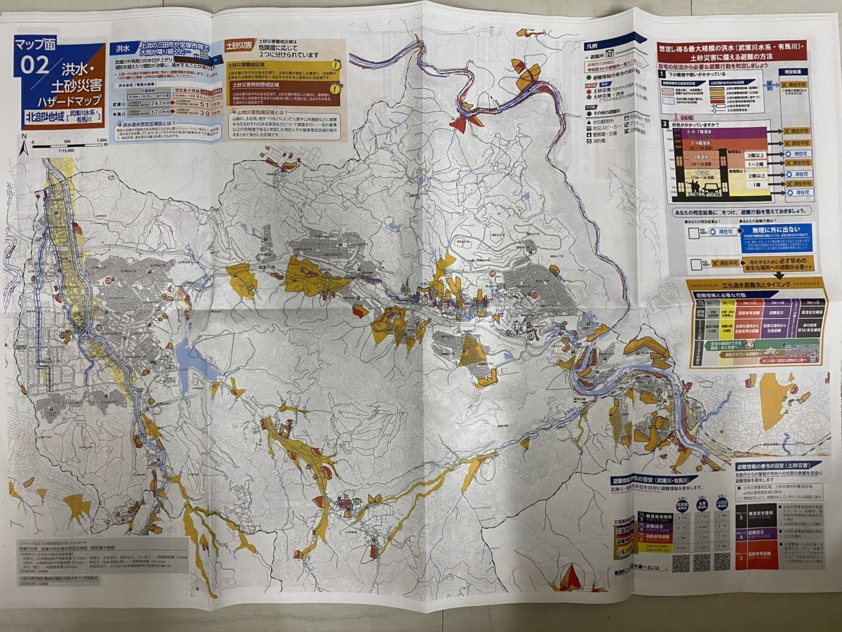
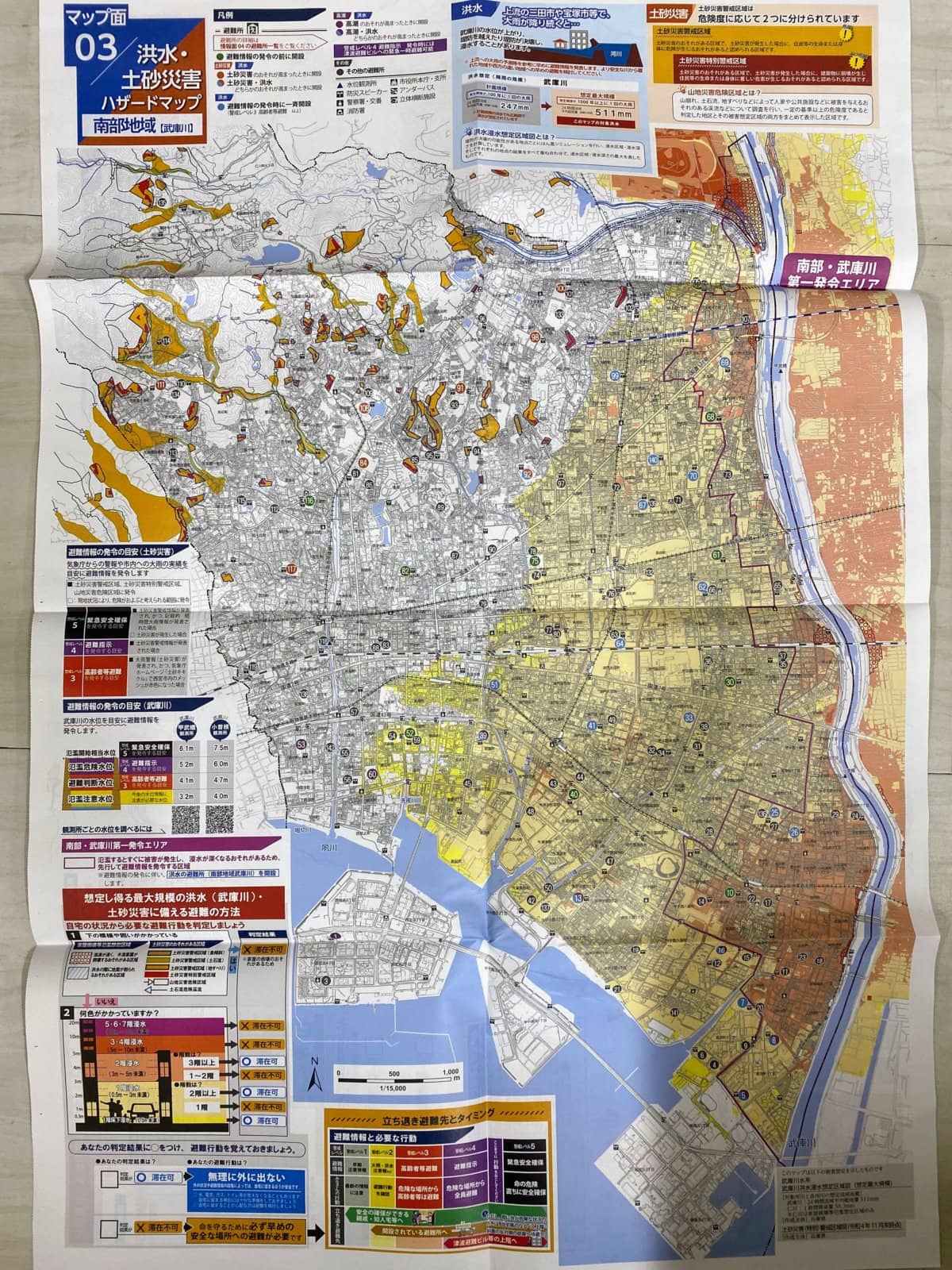
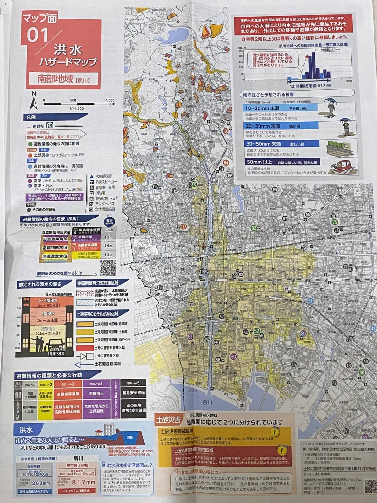
Flood and Landslide Hazard Maps
Northern area↓
Southern area↓
Shukugawa Flood Hazard Map
Please take another close look at where you live, your workplace, places you often go, and other important locations, and check them carefully~
Finally
Students and their parents may be feeling anxious about whether a warning will be issued and whether they should go to school. I’m writing this article as of 4 a.m., and heavy rain warnings have been issued for places such as Akashi City and Kakogawa City. By the way, no storm warning has been issued. Sorry, Shachomi will be sound asleep in the morning, so I won’t be able to update the article🙏