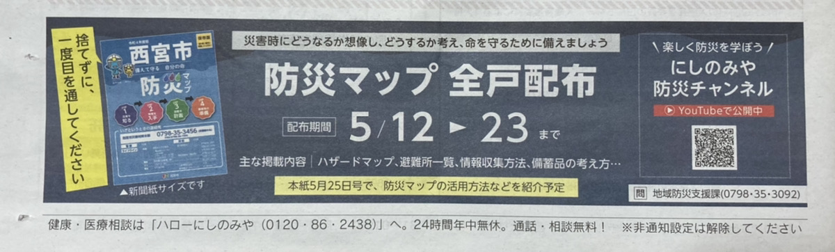
From May 12 to 23, the “2022 Nishinomiya City Disaster Prevention Map” is being distributed.
There was also an announcement in the 5/10 city newsletter↓
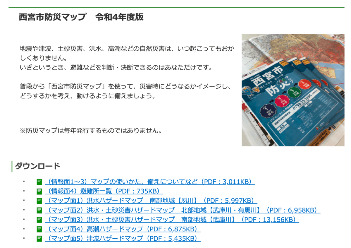
You can also download it from the Nishinomiya City website😀
Screenshot from the Nishinomiya City official website
If it hasn’t arrived yet and you want to check it quickly, you can do so here〜.
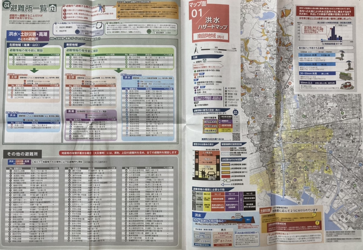
List of Nishinomiya City Disaster Prevention Maps
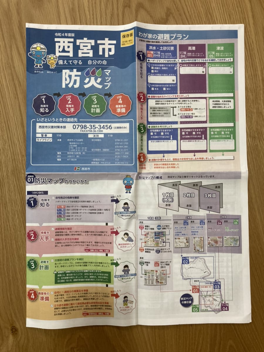
There is also a section where you can fill in “My Family’s Evacuation Plan”〜.
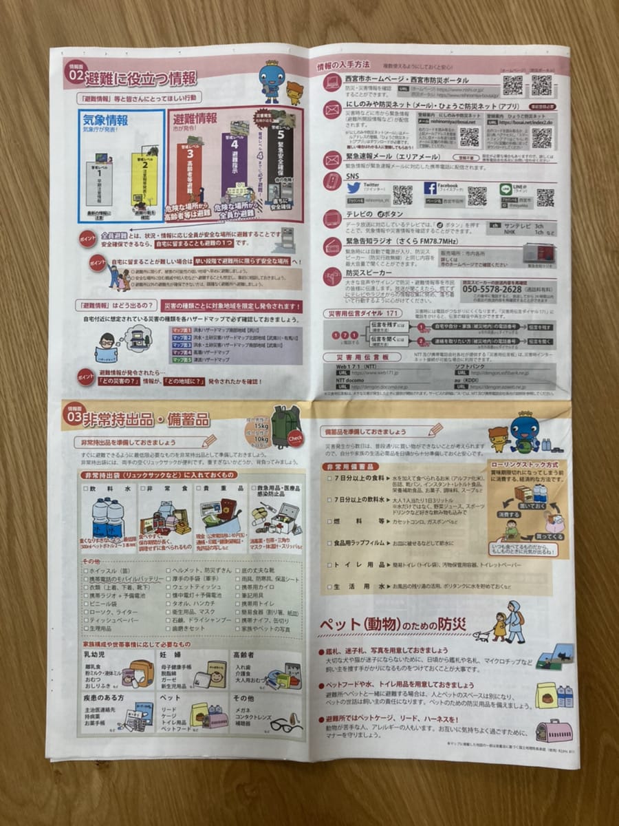
“Useful Evacuation Information” and “Emergency Carry-Out Items / Stockpiled Supplies”↓
List of Evacuation Shelters & ① Flood Hazard Map (Southern Area)↓
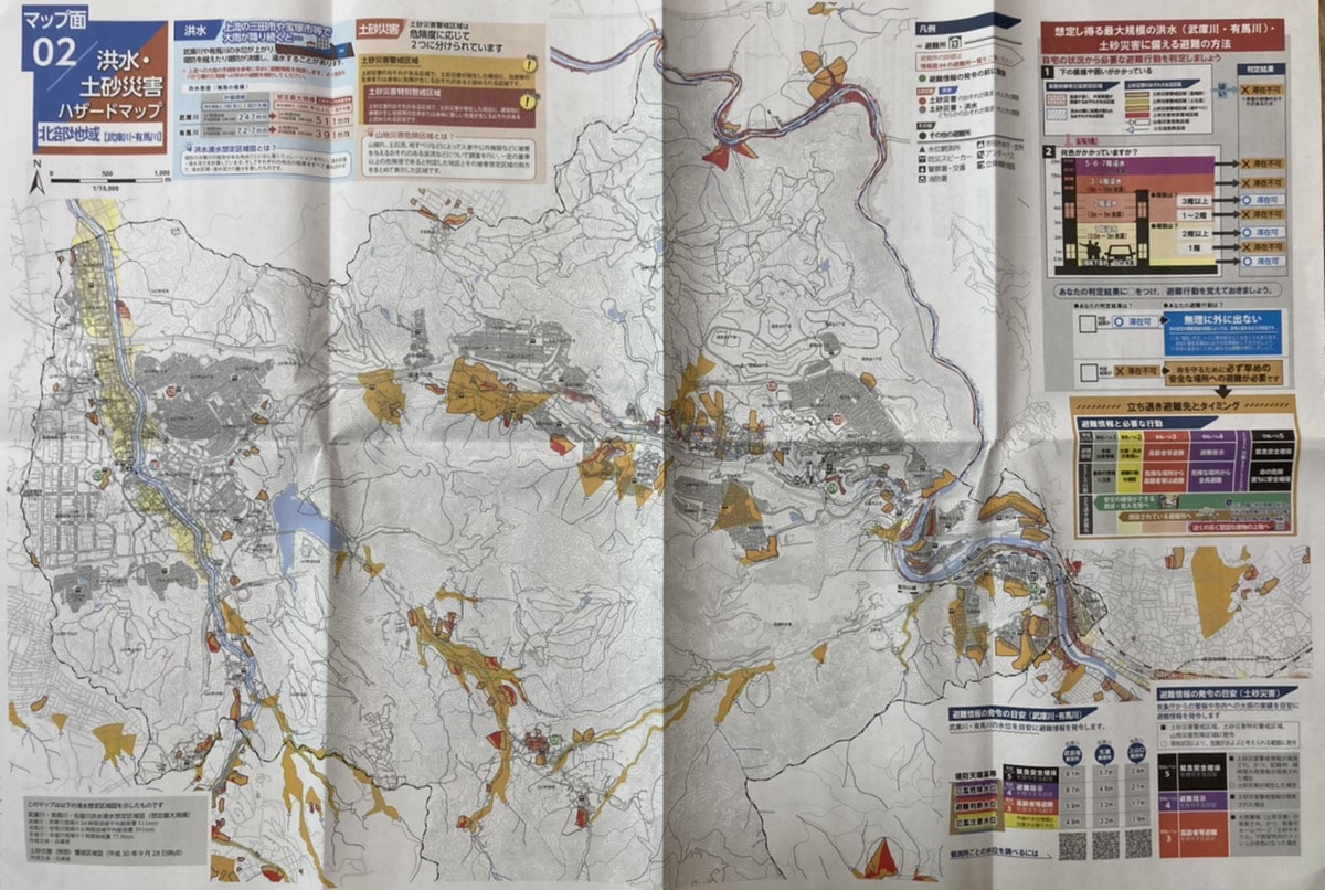
② Flood and Landslide Hazard Map (Northern Area)↓
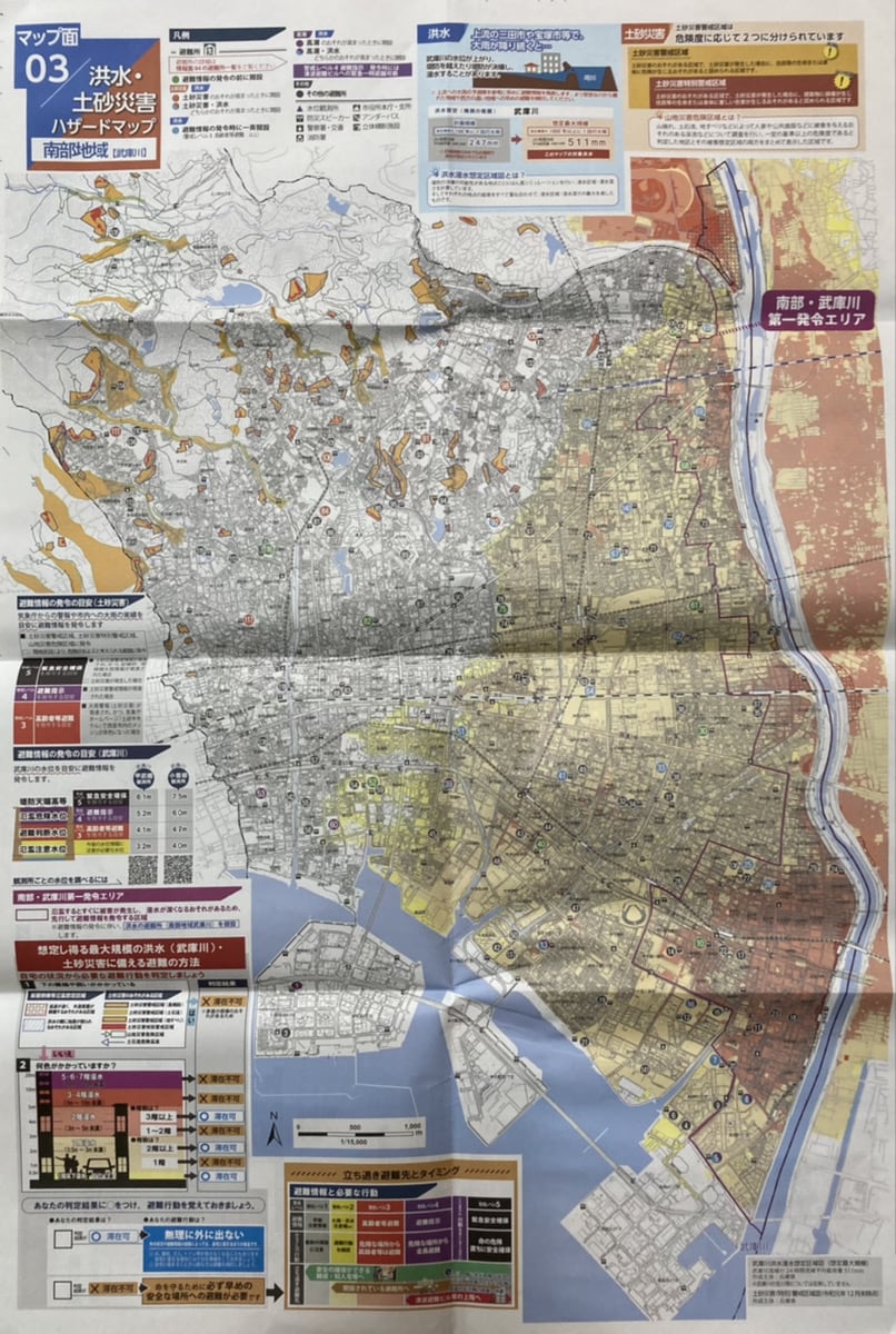
③ Flood and Landslide Hazard Map (Southern Area)↓
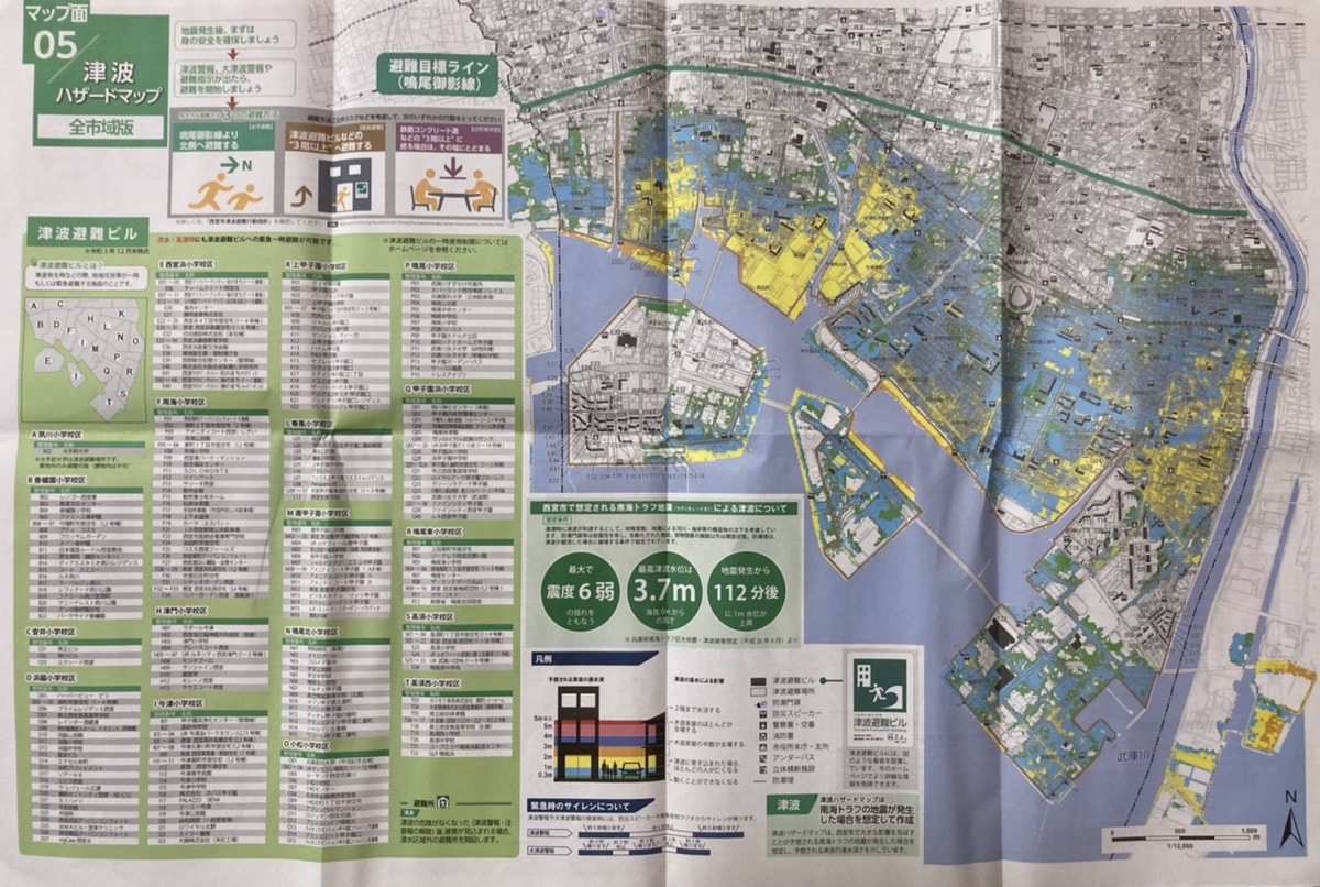
⑤ Tsunami Hazard Map
Finally
During a disaster, you can’t always count on having internet access, so it’s really helpful that they distribute these on paper like this〜! Once it’s dropped in your mailbox, why not talk it over with your family and create your “My Family’s Evacuation Plan”?😊