A feature that simply introduces the borders between Nishinomiya City and its neighboring cities [Nishinomiya City Borders] By the way, 市境 is apparently read as “shikyo,” not “shizakai.” Though you can’t convert it that way when typing.
Head up Tateishi-suji, past Koyama High School and TAOCA COFFEE, and keep going much, much farther up.
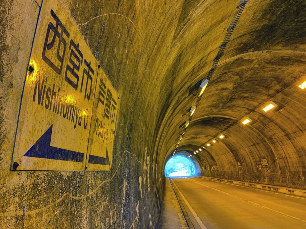
On the road to the summit of Mt. Rokko, there is a tunnel called “Hachimakiyama Tunnel.”
Inside that Hachimakiyama Tunnel, we found the city border between Nishinomiya City and Ashiya City.
Here↓↓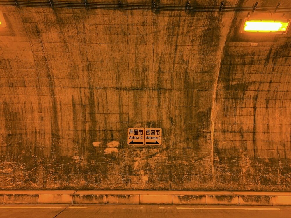
The left side is Ashiya City, and the right side is Nishinomiya.
North of this “Hachimakiyama Tunnel” is a mountain called Ushiro-Hachimakiyama, and its summit is said to be the highest point in both Ashiya City and Nishinomiya City.
So you could say this is the highest “city border” in Nishinomiya.
If you go that way, you’ll be in Ashiya City, and a little farther on is Ikken-Chaya, a rest spot for hikers.
Here it is on the map↓↓
The right side of the map is Nishinomiya City, and the left side is Ashiya City.
If you go a little toward Ashiya, you’ll soon enter Kobe City.
By car, that means you can pass between the three cities of Nishinomiya, Ashiya, and Kobe in just a few seconds.
Here is the plate showing the tunnel name, client, and other details↓↓
“Hachimakiyama Tunnel” is located almost exactly between Nishinomiya and Ashiya, but the tunnel was actually built by “Kobe City.”
That feels a little mysterious, doesn’t it?