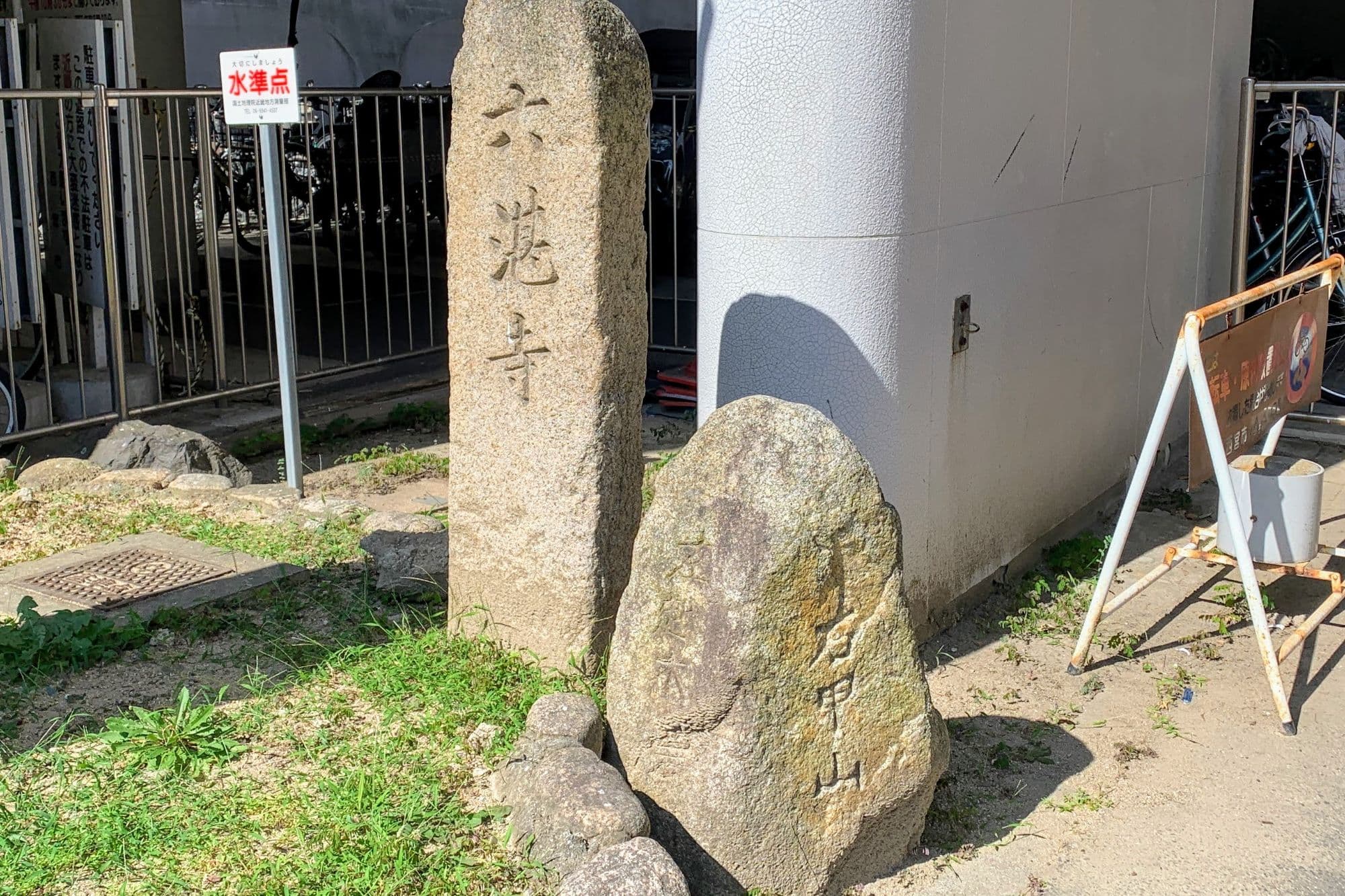
When we made a quiz about Rokutanji-cho, where City Hall is located,
there was this old road sign between City Hall and Amity Hall↓
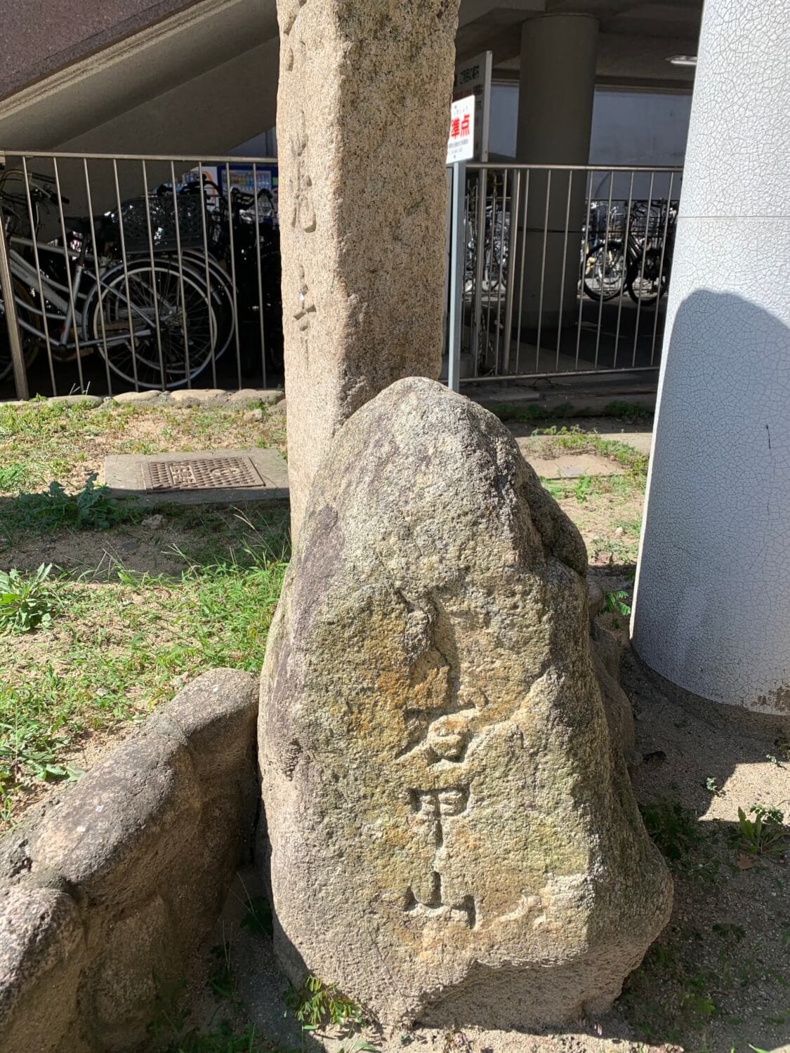
It clearly says Right: Kabutoyama,
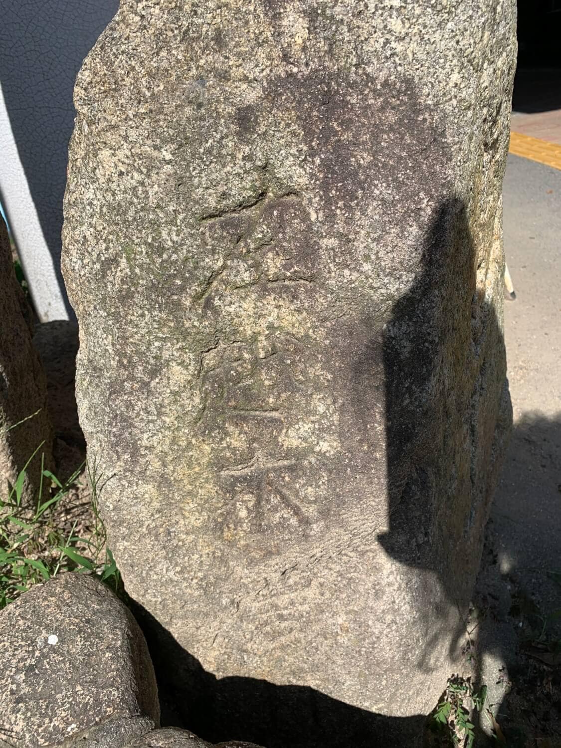
and although it’s really hard to read, it says Left: Koshikiiwa ^^;
When we went back later to photograph the shaded part, it actually said Koshikiiwa Village…
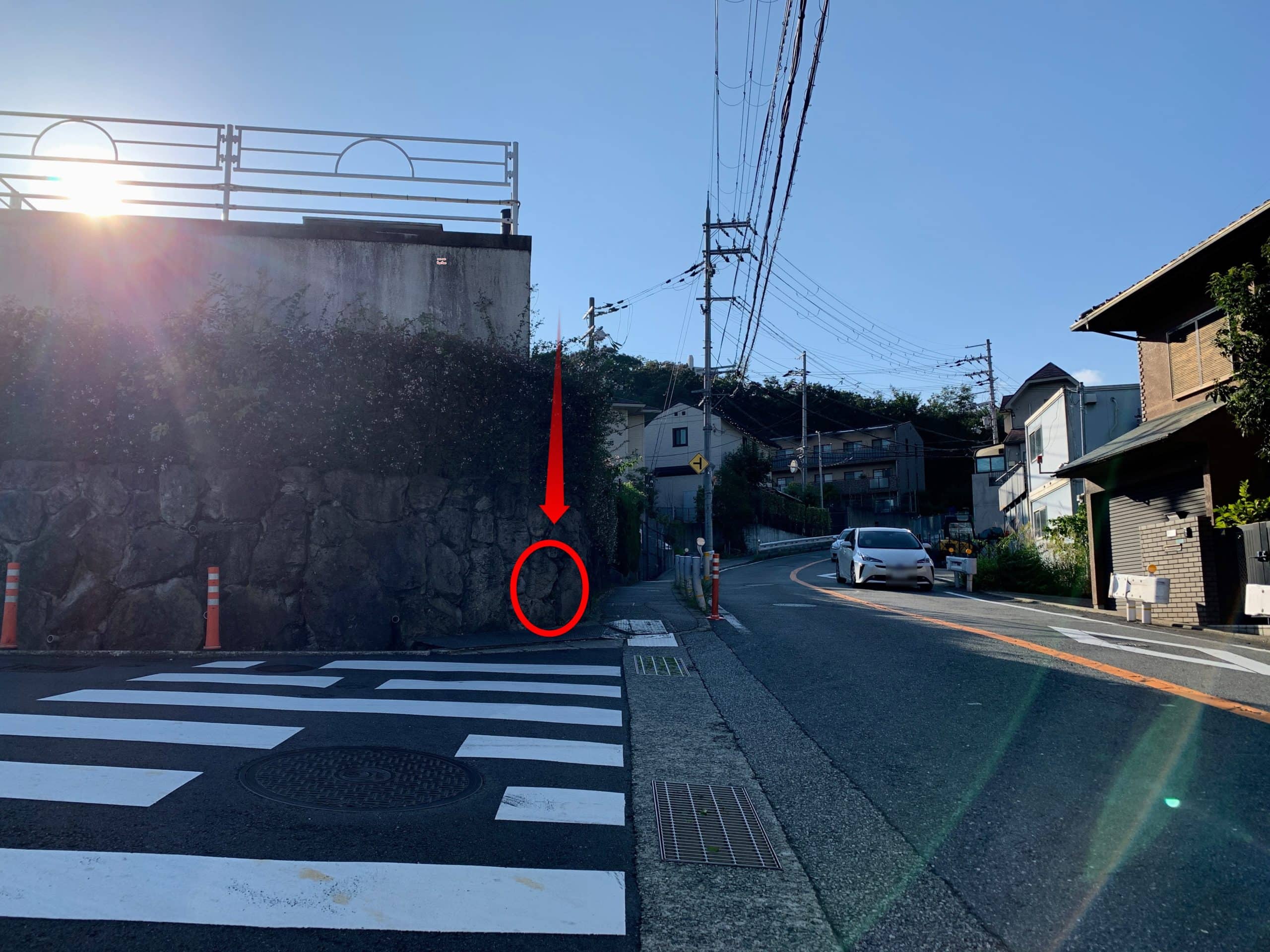
But obviously, if it’s here, you can’t get to either place (ーー;)
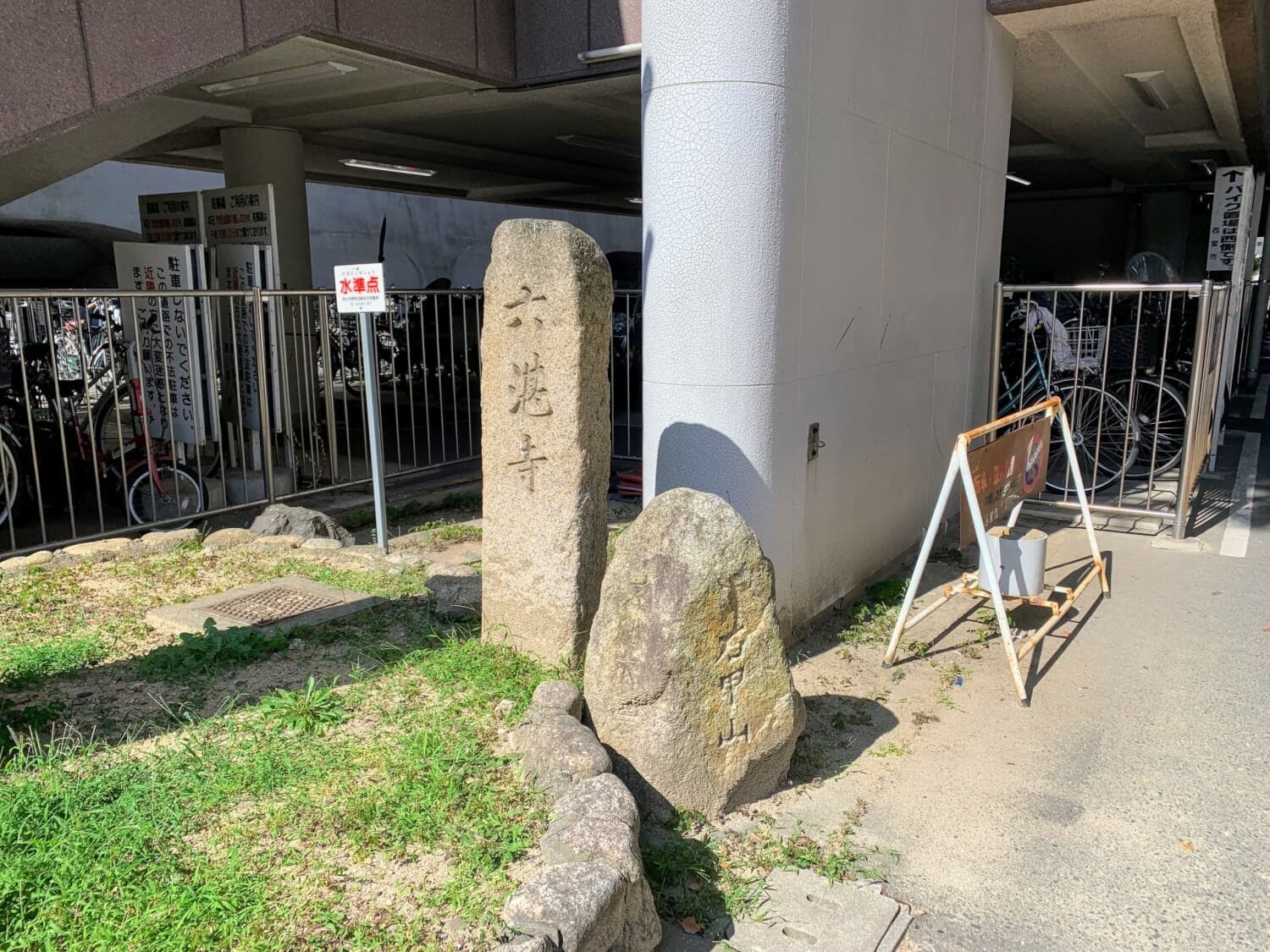
So we decided to just pick a spot around here where it would make sense!
Basically, we took it upon ourselves to find a place where you could actually get to both destinations\(^o^)/
Here↓
Today, the Koshikiiwa area has a neighborhood association, which also runs a website called “Koshikiiwa, a Town That Creates Dreams and Romance”.
The area covers 18 neighborhoods:
Nishihira-cho, Matsukaze-cho, Ishibane-cho, Horaku-cho, Sakura-cho, Minami-Koshikiiwa-cho, Oimatsu-cho, Hinōike-cho, Koshikiiwa-cho, Bishamon-cho, Kadoishi-cho, Misaku-cho, Oimatsu-cho (part), Hinōike-cho (part), Kikutani-cho, Matsuo-cho, Kudenigatani-cho, Matsugaoka-cho, Fukatani-cho (part), and Kitsuyama-cho (part).
Finally
The road sign next to City Hall was apparently discovered underground during construction of the new government building, but it seems to have been moved several times.
In “Nishinomiya Historical Walk Guide Map,” published by the City Board of Education in 2008, it is said that the sign “was around Oide Bridge, near the fork in the road leading to Kabutoyama and Koshikiiwa Village.”
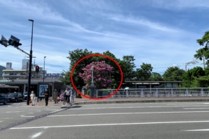
Oide Bridge is here on the map↓