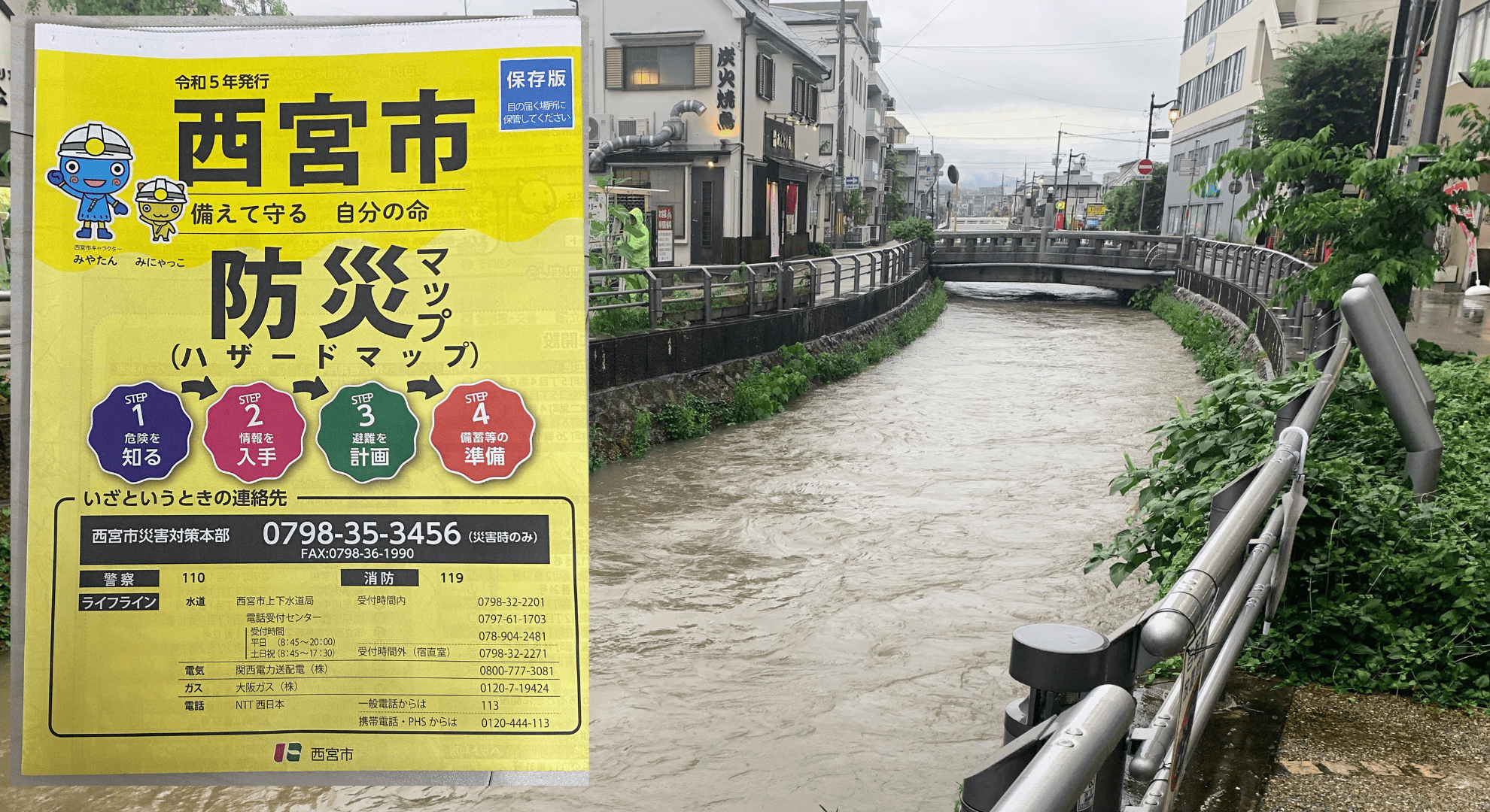
It looks like the “Nishinomiya City Disaster Prevention Map” has been distributed to every home in Nishinomiya.
In this article, we’ll highlight the key points you should check on the disaster prevention map so you don’t miss anything important.
Here it is↓
For those who haven’t received the disaster prevention map, you can download it from this page.
目次
Heavy rain fell again today, and a landslide occurred just the other day
Today, 5/15, the rain only lasted a short time, but it came down quite heavily.
ゲリラ雷雨っぽいですね。雷もなった感じ⚡️ pic.twitter.com/xvyIJUDxiV
— 西宮つーしん (@nishi2shin) May 15, 2023
The other day, on 5/10, Nishinomiya saw record-breaking rainfall, and a landslide occurred in Mondo-Yakujin, leading to an evacuation order.
This was an area not expected on the disaster prevention map.
That’s exactly why it’s probably safest to at least carefully check the areas that are shown as risks on the disaster prevention map.
What to check on the disaster prevention map
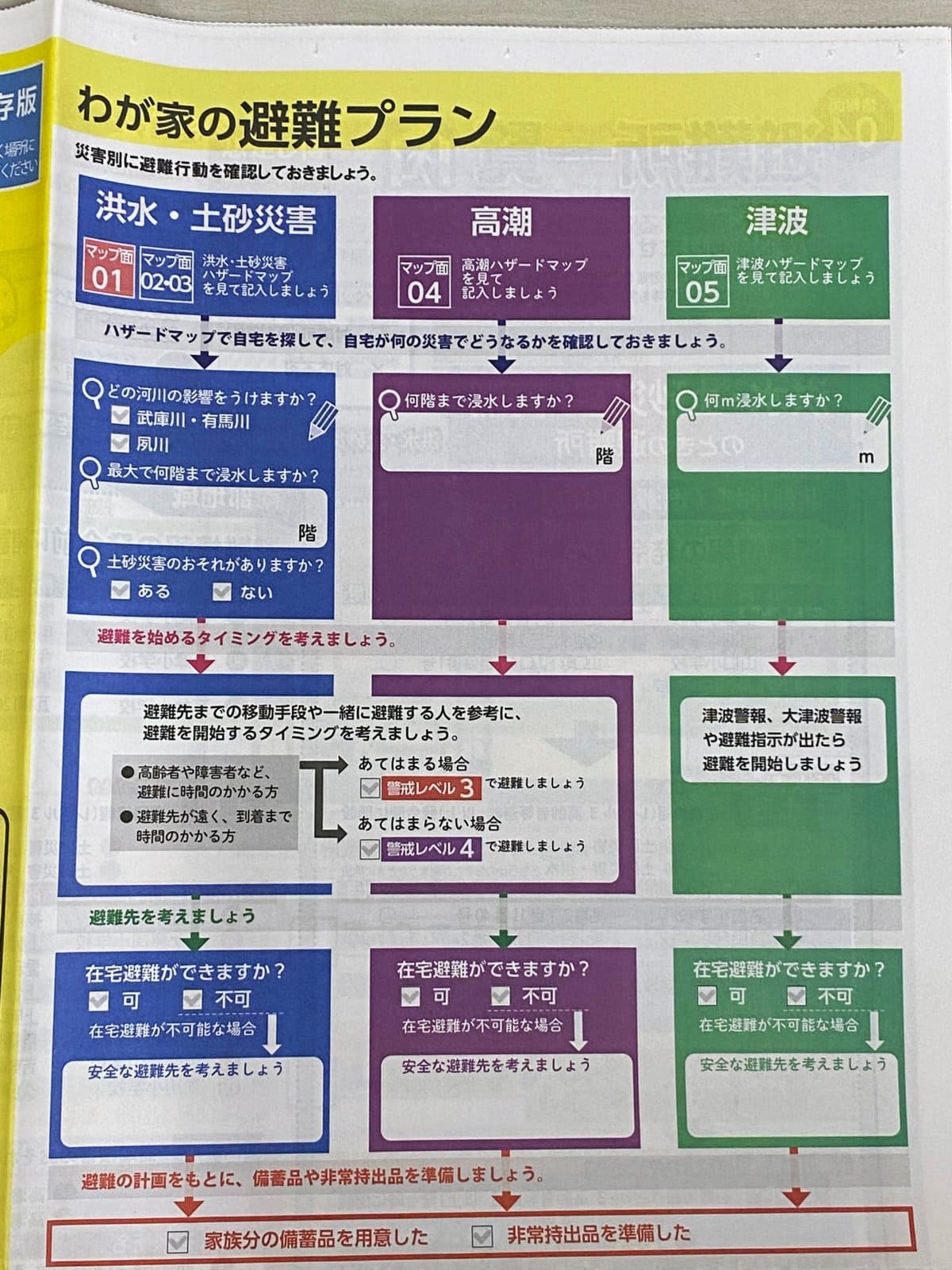
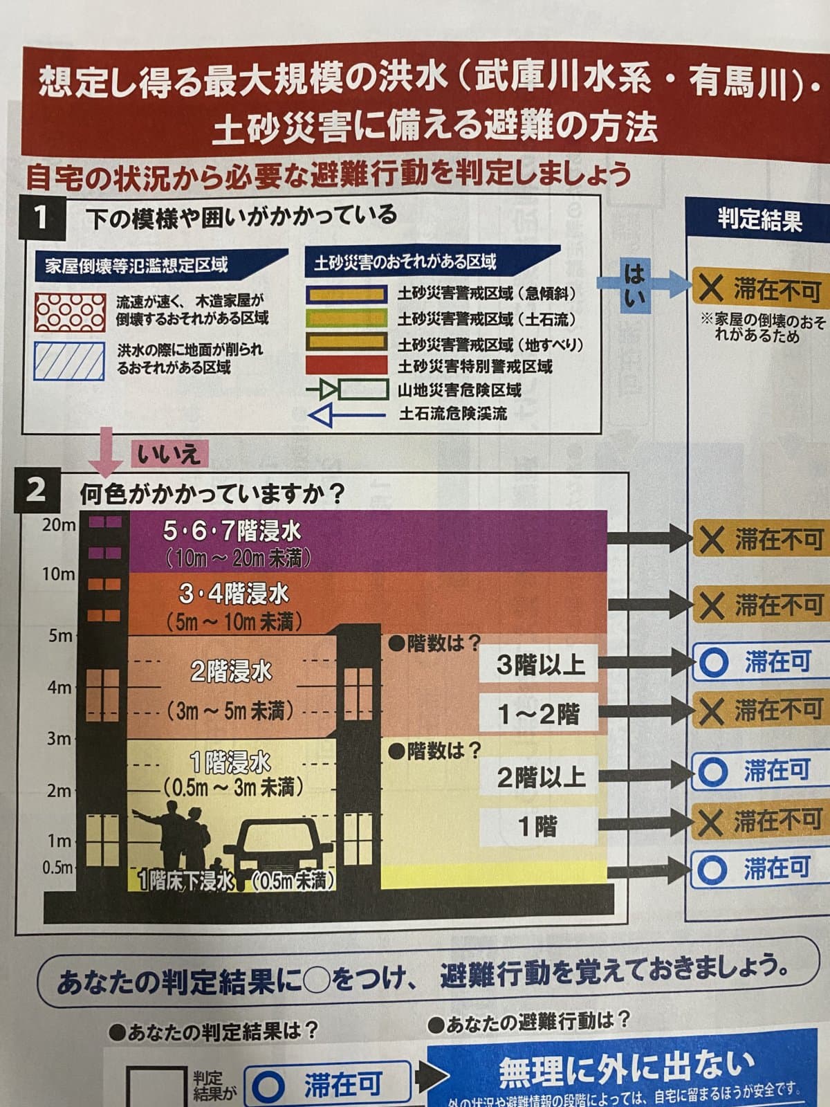
It’s designed so you can write directly on it like this.
What you need to check on the disaster prevention map is simple.
For the three scenarios of ① flooding, ② storm surge, and ③ tsunami, write down how many meters of flooding are expected at your home, workplace, and school. That should help you act calmly in an emergency. Of course, be sure to check places you often go to as well!
List of disaster prevention maps
Now let’s take a look at the disaster prevention maps for flooding, storm surge, and tsunami.
① Flood and Landslide Hazard Map
These are the flood and landslide hazard maps for the northern area, southern area [Muko River], and southern area [Shukugawa].
Northern area↓
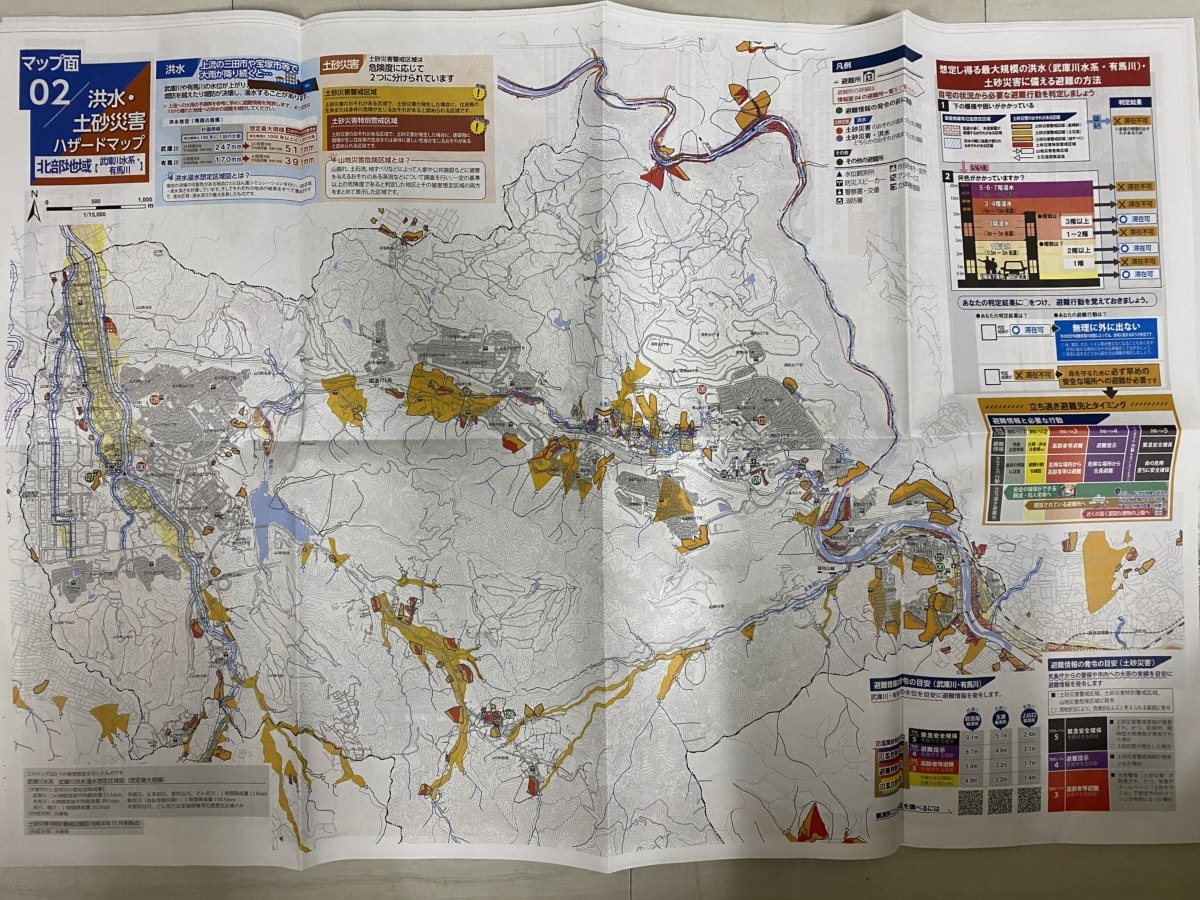
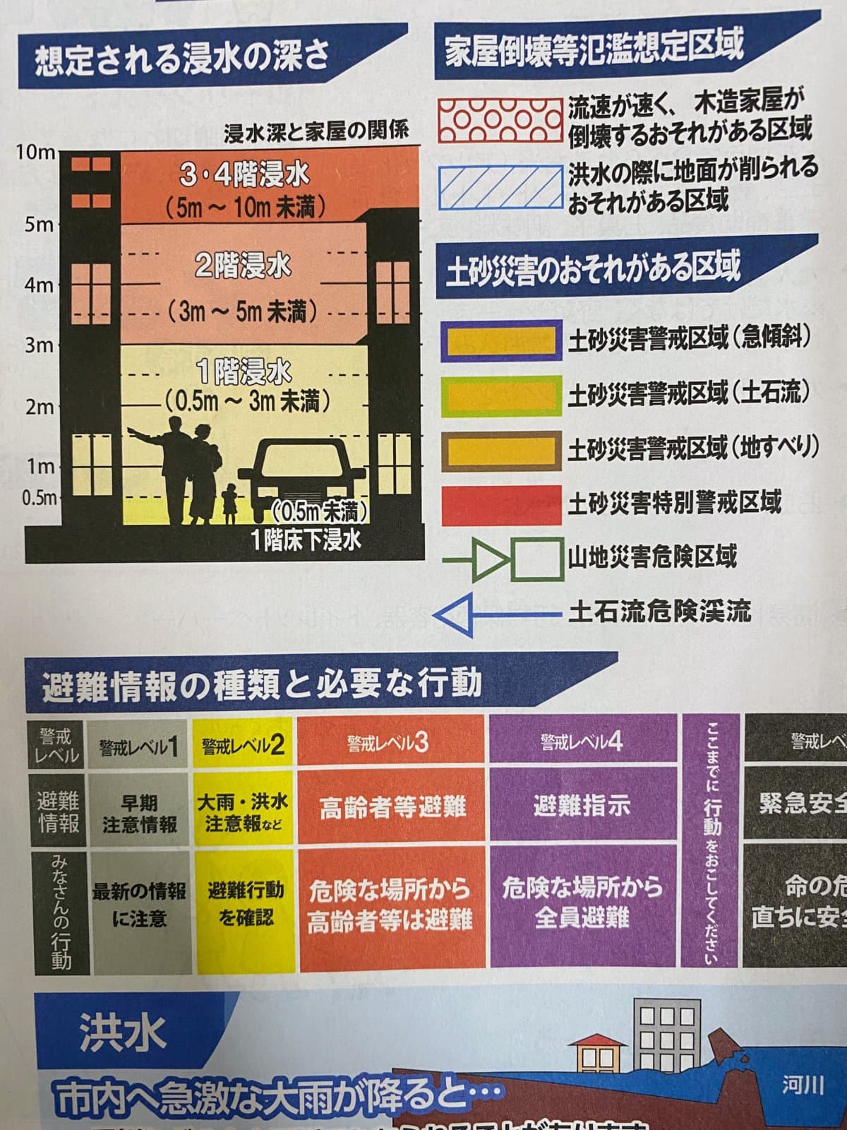
Check which colors are dangerous↓
From pale yellow to orange, the entire first floor is unsafe. Once it turns orange, even the second floor is unsafe.
Map you can enlarge↓
→(Map Side 2) Flood and Landslide Hazard Map Northern Area [Muko River System / Arima River] (PDF: 7,126KB)
Southern area [Muko River]↓
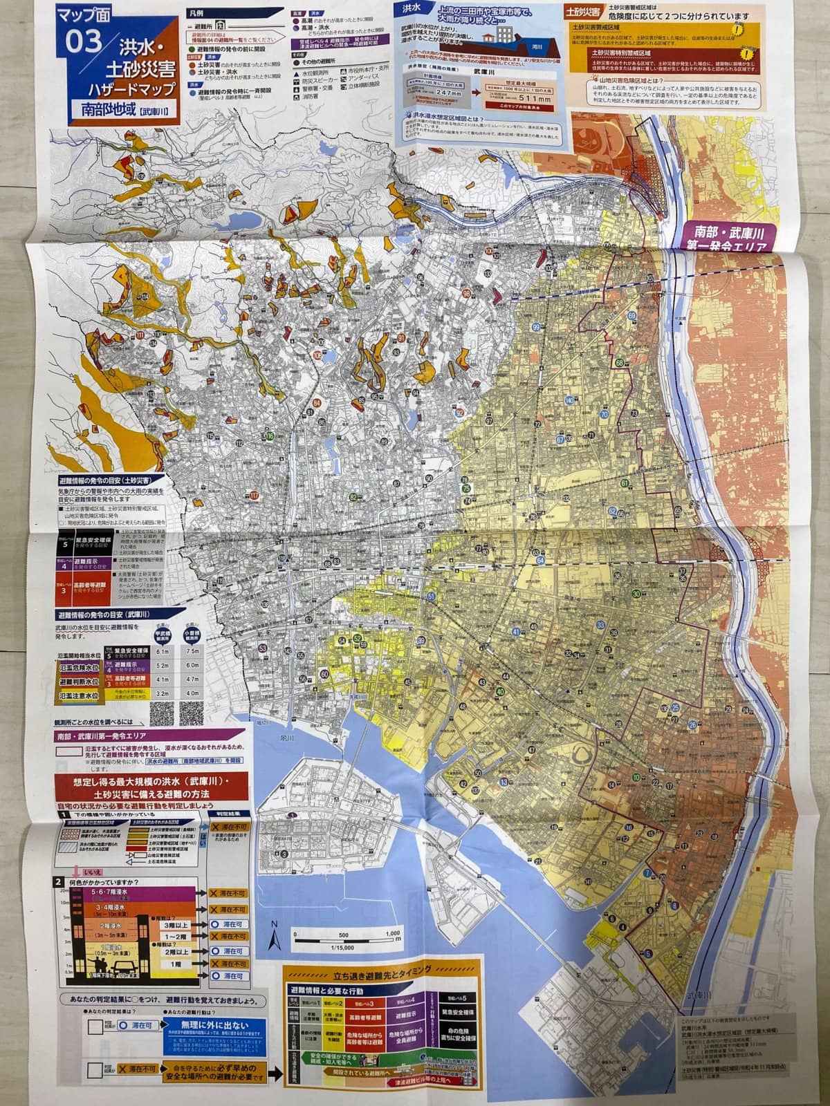
Check which colors are dangerous↓

From pale yellow to orange, the entire first floor is unsafe. Once it turns orange, even the second floor is unsafe.
Map you can enlarge↓
→(Map Side 3) Flood and Landslide Hazard Map Southern Area [Muko River] (PDF: 13,251KB)
Southern area [Shukugawa] 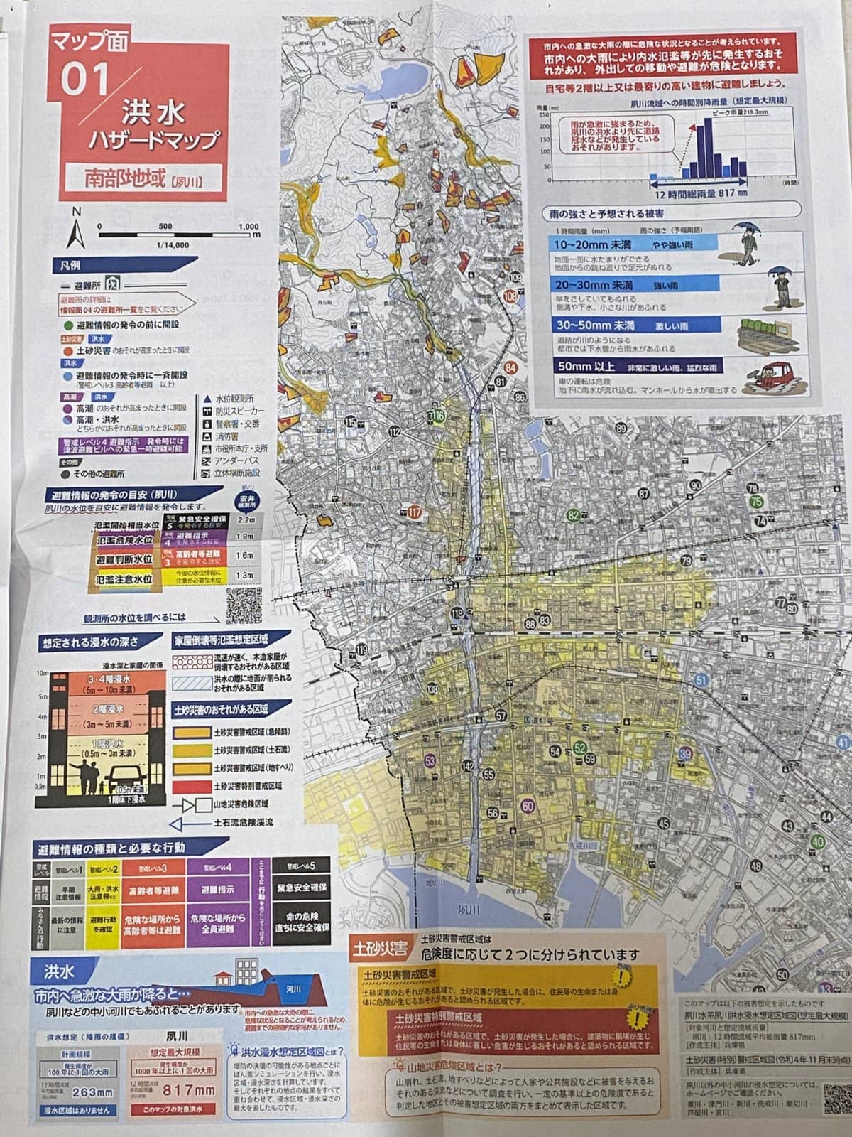
Check which colors are dangerous↓
There are several red areas for landslide hazards, so please be careful.
Map you can enlarge↓![]()
![]()
→(Map Side 1) Flood Hazard Map Southern Area [Shukugawa] (PDF: 5,978KB)
② Storm Surge Hazard Map
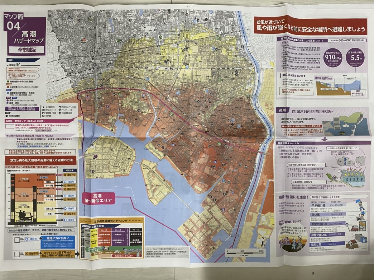
Check which colors are dangerous↓
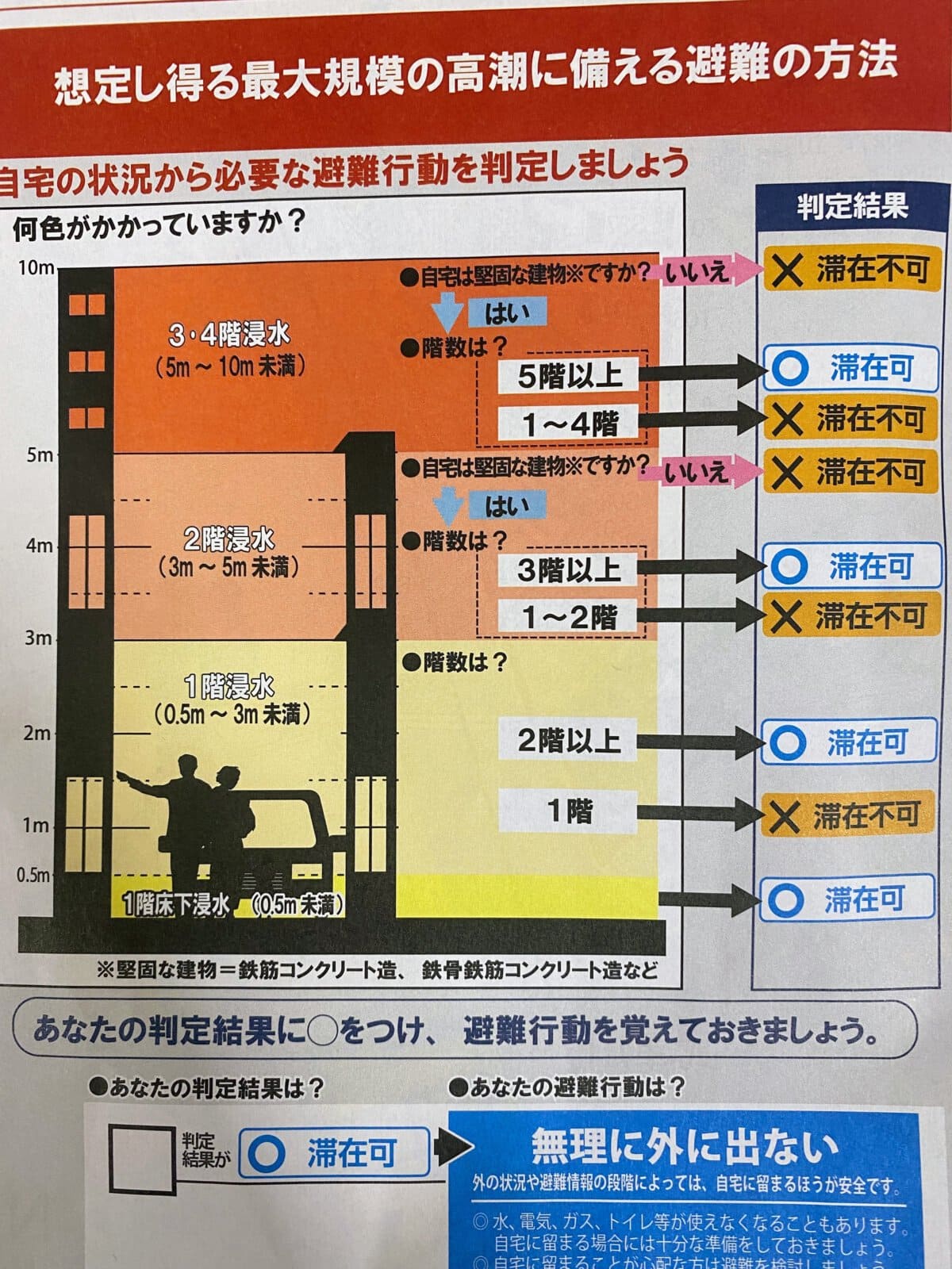
From pale yellow to orange, the entire first floor is unsafe. Once it turns orange, even the second floor is unsafe.
Map you can enlarge↓
→(Map Side 4) Storm Surge Hazard Map (PDF: 6,895KB)![]()
![]()
③ Tsunami Hazard Map
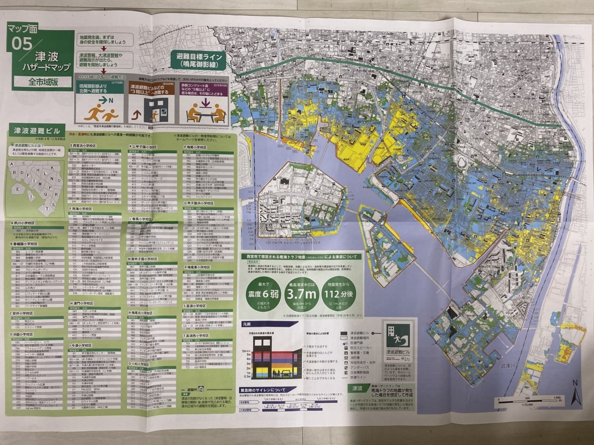
Check which colors are dangerous↓
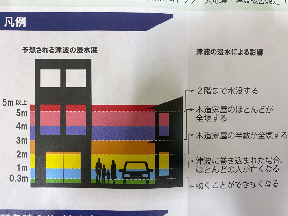
In the case of a tsunami, even 1m or 2m of water can be fatal if you’re outside.
In Nishinomiya, there are blue, yellow, and orange areas, so please be careful.
Map you can enlarge↓
→(Map Side 5) Tsunami Hazard Map (PDF: 5,451KB)
How to use the map, evacuation sites, and more
![]()
![]() This section summarizes how to use the map, emergency items to take with you, and supplies that are good to keep stocked. We’ll continue adding more details to this article.
This section summarizes how to use the map, emergency items to take with you, and supplies that are good to keep stocked. We’ll continue adding more details to this article.
(Information Side 1–3) How to Use the Map, Preparedness Information, etc. (PDF: 2,922KB)
There is also information about evacuation sites, including whether pets are allowed. This is something you’ll want to check in advance.
![]()
![]() (Information Side 4) List of Evacuation Shelters (PDF: 734KB)
(Information Side 4) List of Evacuation Shelters (PDF: 734KB)
Finally
Recently, there was an M6.5 earthquake with a seismic intensity of upper 6 in Ishikawa Prefecture, and earthquakes also occurred in southern Chiba Prefecture and the Tokara Islands. A landslide has happened in Mondo-Yakujin as well, so this really isn’t someone else’s problem. It would be best to take another careful look at this “Nishinomiya City Disaster Prevention Map” and confirm how your family will stay in touch and where your evacuation shelter is.