It looks like Nishinomiya City’s hazard map has been updated.
(Information provided by Hank)
Quoted from “Nishinomiya City LINE”
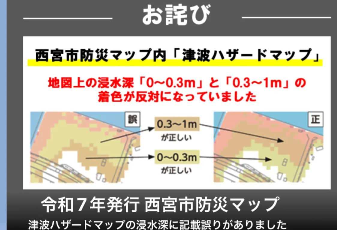
It seems that yellow (up to 0.3m) and brown (up to 1m) had been swapped around.
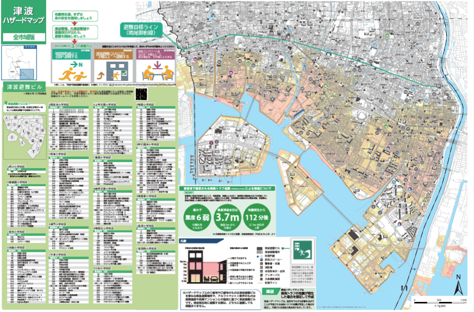
The newly corrected version looks like this. Hyogo Prefecture is currently reviewing its damage estimates for a Nankai Trough earthquake for the first time in 12 years, so the version scheduled to be delivered to our homes will reflect those results. If you need it sooner, you can also view it on the “Nishinomiya City website”!
Finally
The explanation for 0.3 to 1m says, “If caught in a tsunami, most people will die,” so this is important information for anyone living in those areas.