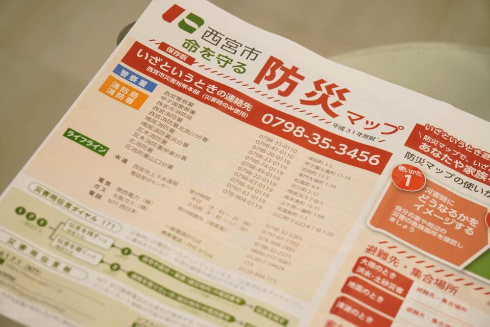
It looks like the “Nishinomiya City Disaster Prevention Map” was distributed to every household in Nishinomiya in mid-May.
Here it is↓
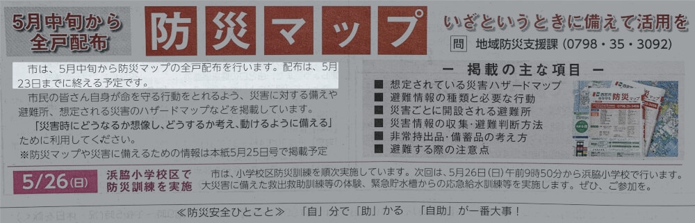
Distribution is scheduled to be completed between mid-May and the 23rd.
If you haven’t received it yet, it should arrive by the 23rd.
If it still hasn’t arrived by May 24, please contact the Community Disaster Prevention Support Division at Nishinomiya City Hall (0798-35-3092).
If you’re thinking, “A PDF of the disaster prevention map is enough for me,” you can download the PDF below.
Nishinomiya City Disaster Prevention Map (2019 Edition): How to use the map, preparations, evacuation shelters, etc. (PDF: 4,201KB)
Source: About the Nishinomiya City Disaster Prevention Map | Nishinomiya City website, PDF link list from City Hall
The Tsunami Legend Feels Realistic and a Little Scary
There is a tsunami legend, and it states that for a tsunami of 1m to 2m, “most people will die if caught in the tsunami.”
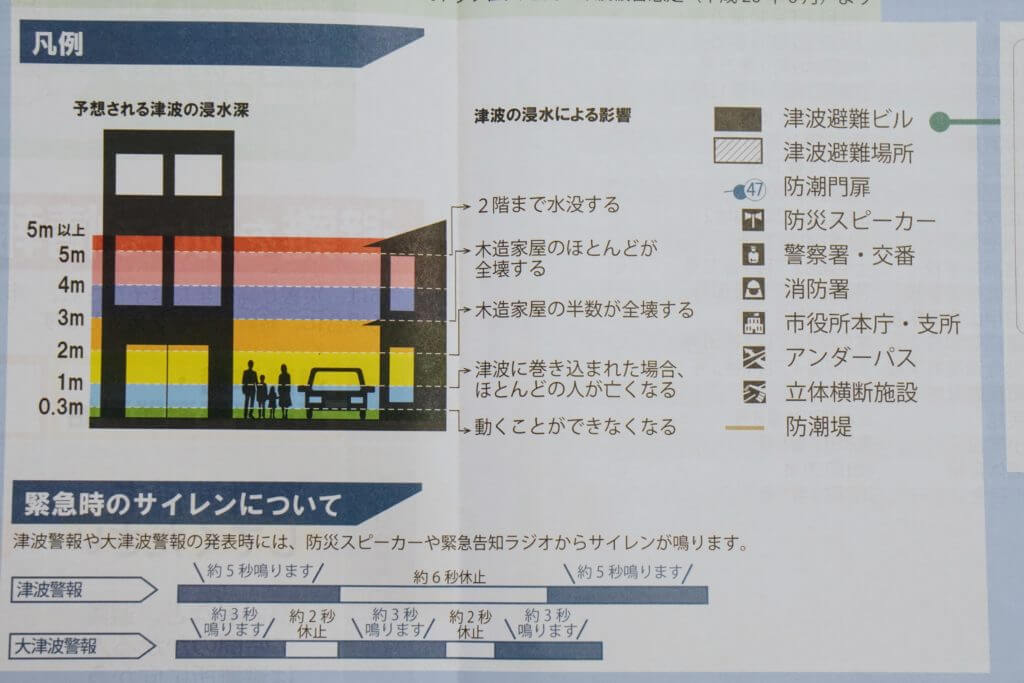
Apparently, even a 0.3m tsunami, or about the height of the long side of an A4 sheet of paper, can “make it impossible to move.”
It really drives home the importance of evacuation.
Contents Included in the Map
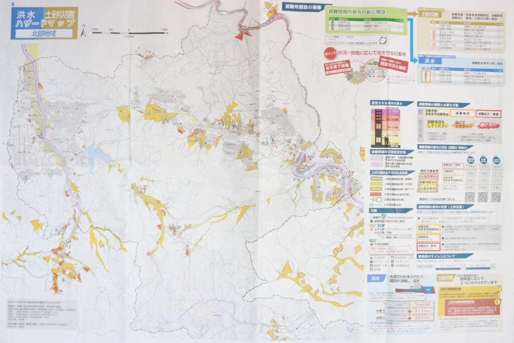
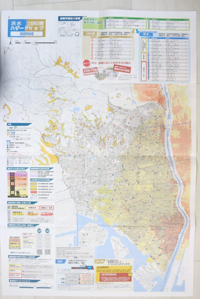
The following three types of maps are included in newspaper-spread size.
Flood and Landslide Hazard Map (Northern Area)
Flood and Landslide Hazard Map (Southern Area)
Tsunami Hazard Map
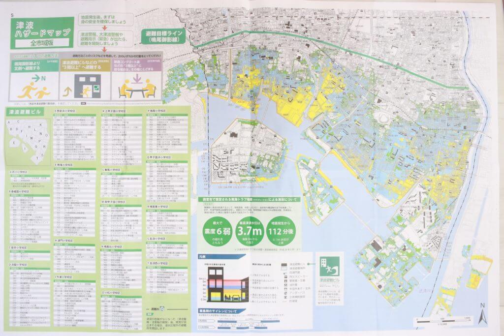
There is also a list of “tsunami evacuation buildings” to evacuate to in the event of a tsunami, organized by elementary school district.
Please be sure to check it.
If you’d like to take a closer look, try downloading the PDF from City Hall.
Source: About the Nishinomiya City Disaster Prevention Map | Nishinomiya City website, PDF link list from City Hall
Finally
Today, developed rain clouds are expected to move across Japan. In the Kinki region, heavy downpours are expected around 9 p.m. This would be a good opportunity to check your evacuation route. Being prepared in advance can be incredibly helpful if something actually happens!