In the past, Nishitsu has published several articles about the “Manbo Tunnel”, a passageway that runs under the JR railway tracks and was even featured on Chacha Ire Monday as “probably the lowest tunnel in Japan.”
There are three of these “Manbo Tunnels” in Nishinomiya.
They’re famous for being extremely low, so we made a ranking of just how low they are!
First, here are the locations of the Manbo Tunnels.
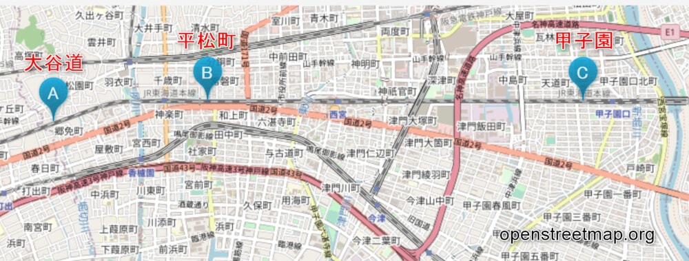
The locations of Nishinomiya’s hidden local landmarks, the “Manbo Tunnels” ↑
(↑©OpenStreetMap contributors)
Apparently, the name Manbo Tunnel doesn’t come from the ocean sunfish, called “manbo” in Japanese.
There seem to be several theories about its origin, but the leading one is that it comes from “manbo” (間歩), a word referring to a public passage in a coal mine.
There’s also a theory that it may have come from the Dutch word “manpu,” meaning tunnel.
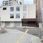
3rd Place: A, Otani-michi
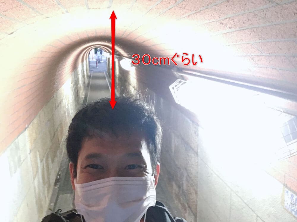
In 3rd place is “Otani-michi,” marked A on the far west side of the map.
At 170 cm tall, I could pass through it with plenty of room.
The tunnel is probably about 200 cm high.
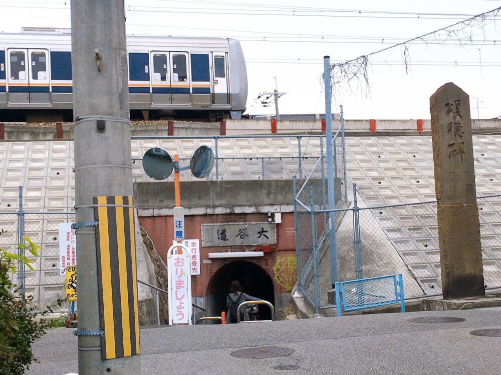
The exterior of “Otani-michi” ↑
It really is a tunnel under the railway tracks!
Apparently, it was originally an irrigation channel that was widened so people could pass through.
2nd Place: B, Hiramatsu-cho
Next is the Manbo Tunnel in “Hiramatsu-cho,” marked B in the middle of the map.
If you stray even a little from the center, it feels just low enough that you might hit your head.
It’s probably just under 180 cm high.
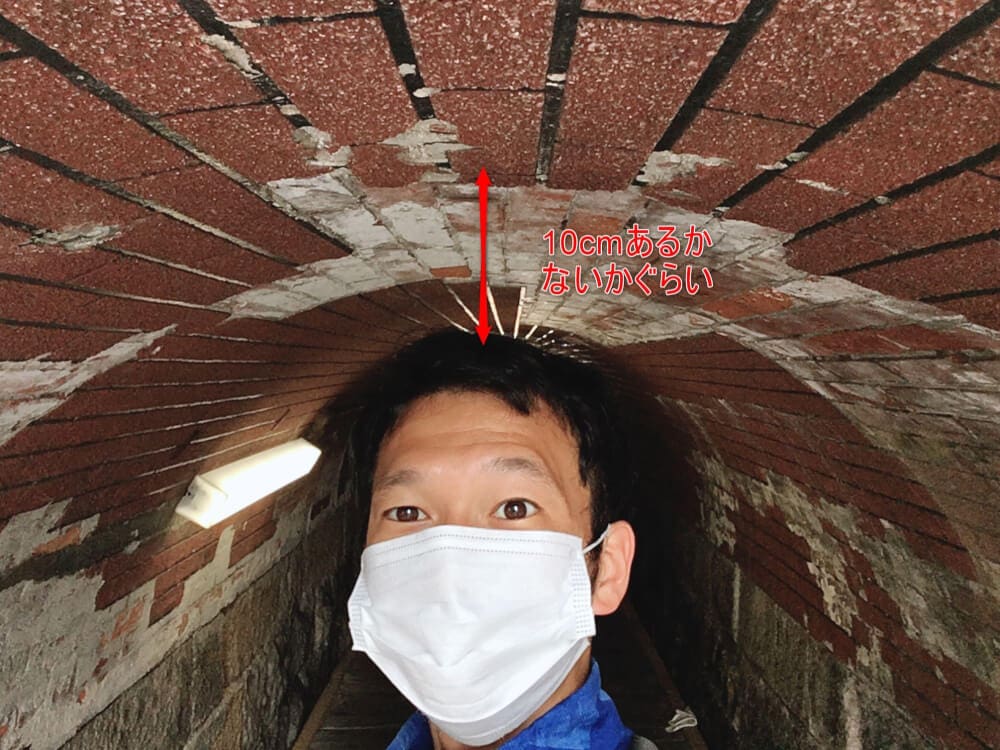
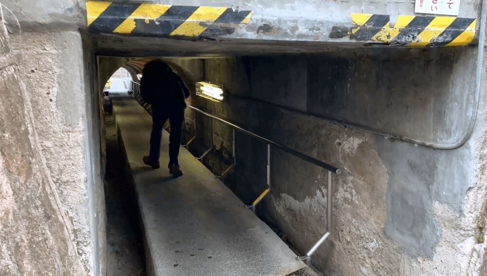
1st Place: C, Near Koshienguchi Station
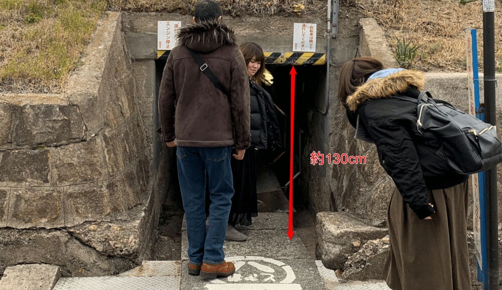
Finally, the third one is the Manbo Tunnel next to JR Koshienguchi Station, marked C on the far east side of the map.
When we measured it during a previous report, it was about 130 cm high!
It might be tough for anyone with lower back pain.
Summary
What we noticed after making this ranking was that,
from west to east, they go “Otani-michi,” “Hiramatsu-cho,” and “Koshien.”
The results were roughly “200 cm,” “180 cm,” and “130 cm,” respectively.
In other words, the west side is higher, and the east side is lower.
Amazingly, it’s just like Japan’s winter pressure pattern: “high in the west, low in the east”!
Now you’re a Nishinomiya expert too♪♪